Coral rubble mounds left behind by previous visitors
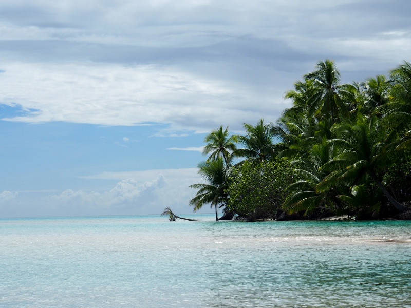
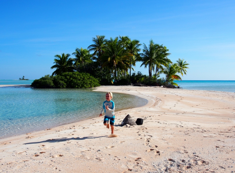
Our last stop in the Tuamotus is Tahanea, an uninhabited atoll south of Fakarava which is a designated protected area because of the rare sandpipers that nest here.
Drifting in the pass
Like all Tuamotuan atolls, Tahanea is a harsh environment, with small motu consisting mainly of coral rubble, coconut palms and hardy bushes clinging onto the thin layer of sand covering the central parts of the thin islets. Apart from the plants, the only obvious sign of life are the numerous large hermit crabs which scurry away as we approach with the odd coconut crab juvenile hidden amongst them.
Arid atoll sporting driftwood trees
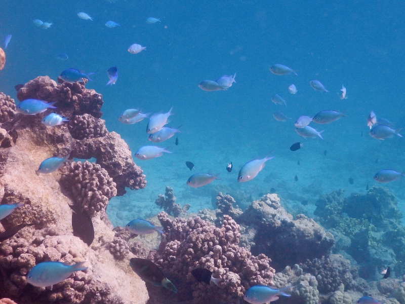
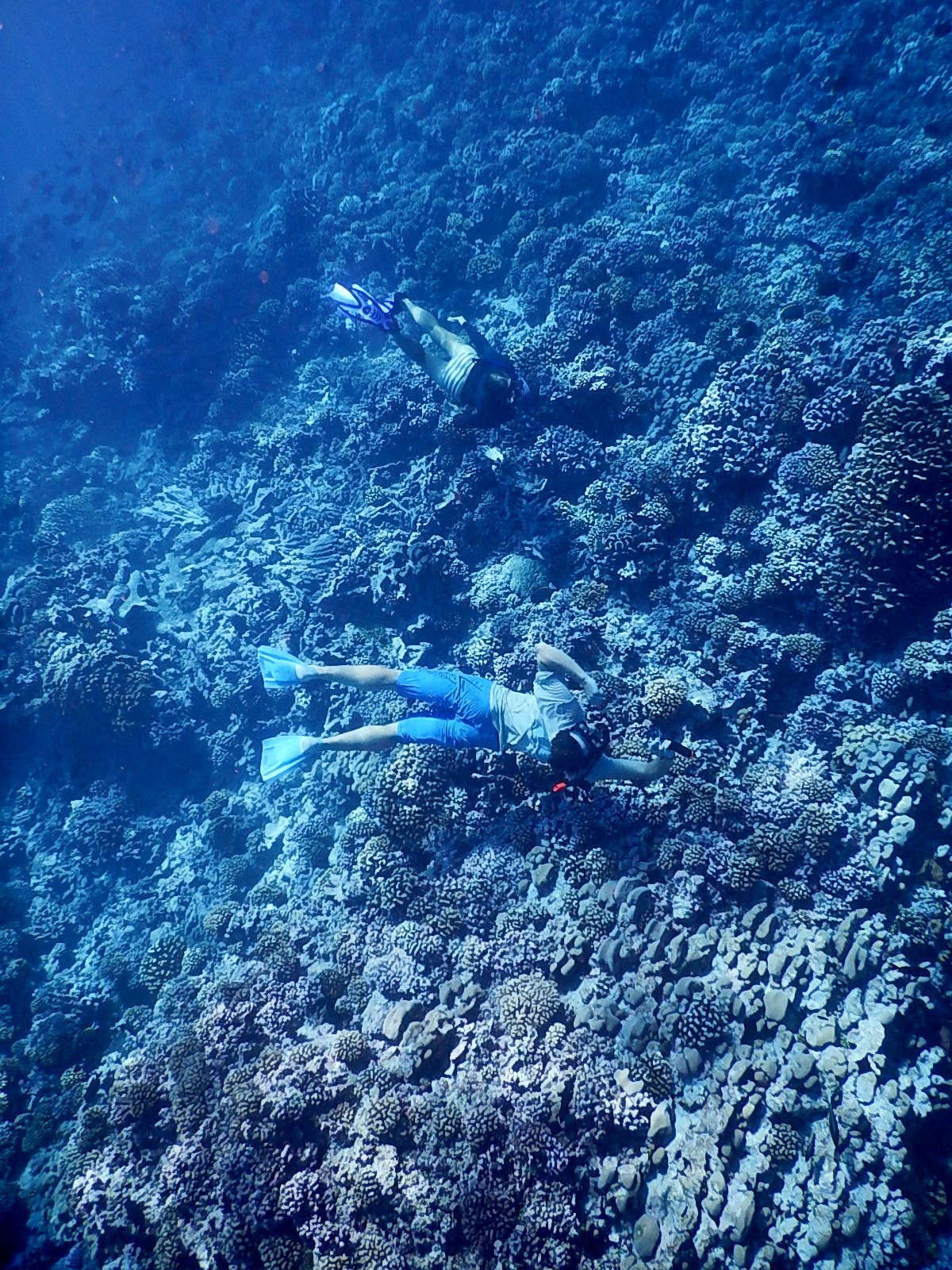
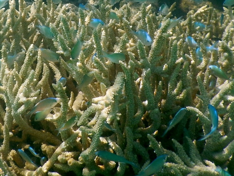
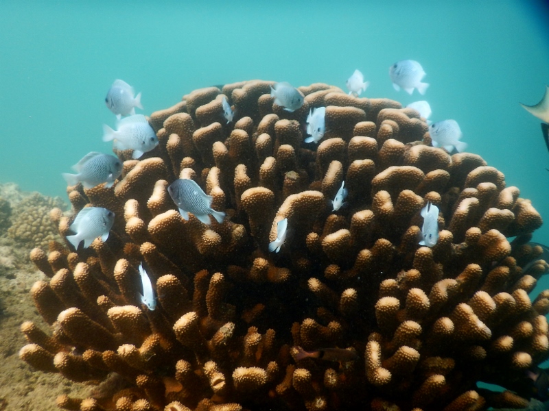
In sharp contrast to the barren and harsh environment above the water is the lush reef below, teeming with life, thick with throngs of fish of every colour and shape. The pass offer the best visibility we’ve ever had, vertigo-inducing drop-offs over which we fly, towing the dinghy like a giant surface marker buoy as we zoom over the corals, scattering the fish.
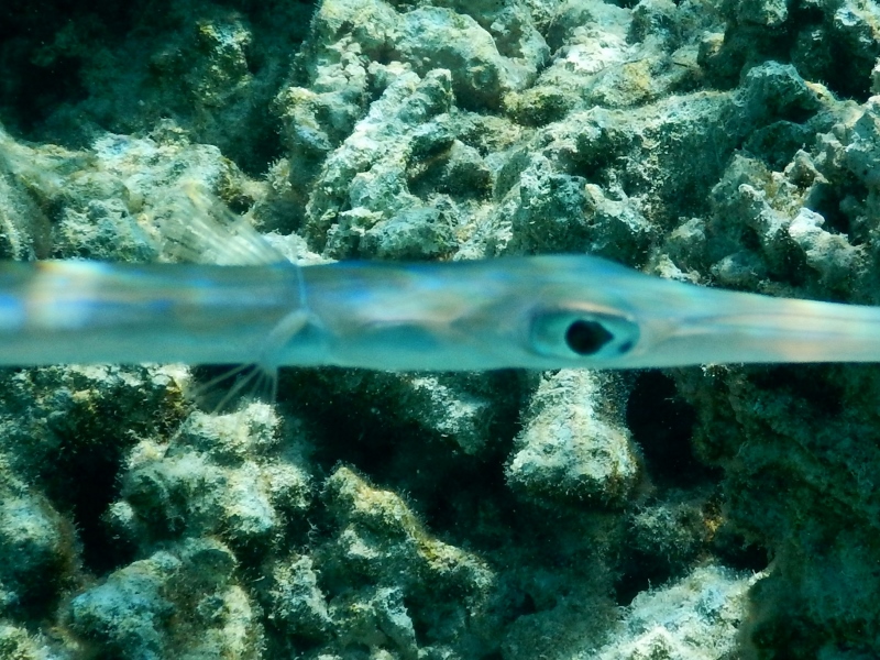
Surrounded by needlefish
Just below the surface hover schools of silvery needlefish, slimlining against the background of the streaks of sunlight that blur the edges between air and water. Their sharp beaks are poised into the current as they sit, ready to pounce at passing plankton. Larger white fish hang just below the surface too, disguising themselves by blending in with the light streaming down from above.
A bit further down in the water column are loose groups of the crazy unicorn fish which often hover below the dinghy. Here in Tahanea the bignose unicornfish flock to our side as soon as we stop the boat, hovering in our shadow like a group of teenagers in a mall after closing hours, waiting for something to happen. They are amazing fish which can change colour rapidly, from a dark browny black to a light blue complete with lemony white edges, their tail spines streaming beautifully behind them. The beautiful humpback snapper also gather densely below any structure they can find.
Dense school of snapper
Just above the beautifully varied coral clusters are the delightfully shy damsels, dazzling in their display of colour, perched as they are above coral patches which they disappear into when they detect our presence. For shy fish they are incredibly conspicuous with their bright colours and heavy patterns: iridescent green, neon blue, black and white stripes, fiery orange, pale lemon yellow or dark with a sharply defined perfectly white tail.
Damsel swarm
Amongst the damsels are more surgeonfish energetically darting back and forth, showing off their brilliant colours and odd shapes. Especially stylish is the Achilles tang with its bright orange tail markings – it look like a fashionable cushion print. Another beauty is the orangespine unicornfish with delicate orange spikes across its tail base. Spines like these are the reason for the common name ‘surgeonfish’ for this family – they are razor sharp and are put to use in territorial defence in the wars of coral fish.
Achilles tang
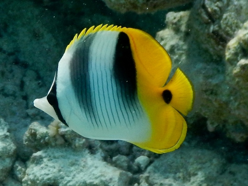
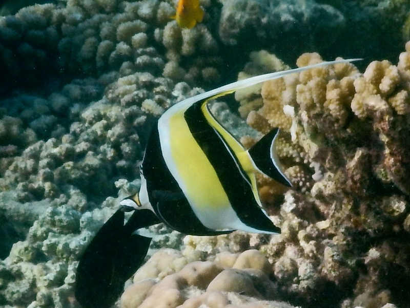
Hanging out with the surgeons are the delicate Moorish Idols, a plane shaped fish with a long dorsal fin filament trailing through the water behind them as their brightly striped yellow and black triangular shapes disappear after their short, pointy noses. They are similar in shape to the quick butterfly fishes that dart in and out of coral crevices, showing off their shimmering yellowy stripes and finely spiked dorsal fins. They are incredibly flat, only displaying a thin stripe with two bulging eyes when viewed front on, magically changing into rounded yellow-white discs as they turn side on.
ButterflyfishMoorish idolGoatfish hoping to remain unnoticed
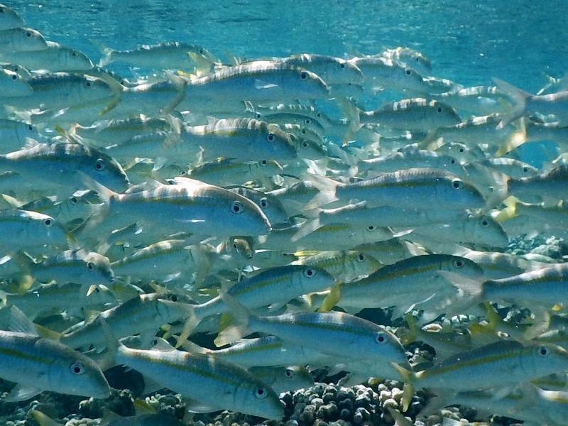
On the sand are huge numbers of pale yellowstripe goatfish, sitting completely still trying to blend in against the white sand, only darting away when we literally swim into them. Big roaming schools of large parrotfish swim by, systematically chewing away at the coral rubble, discharging huge amounts of sandy poop. Apparently much of the sand in the tropics is the result of the digestive processes of parrotfish, a fact easy to believe when you see the clouds of poop discharged by these large fish. The parrotfish have amazing beaks, sharp and pointy and incredibly efficient at cutting coral, and we are happy they are herbivorous. With their bright colours (ranging from brownish red and orange to the common blue green, fading over bright pink to a dusty grey white) and fast beating pectoral (side) fins they do look very much like parrots of a grazing, cow like in their herd attack on the coral meadow.
Parrotfish
Dark fat-lipped groupers poke their heads out of coral caves, the large camouflage groupers swimming aggressively up as we approach, trying to chase us off their patch. Dark peacock groupers gamely change colour as they swim from dark coral to light sand, alternating between brown with blue fin tips on reef to lightly dotted beige over sand. Huge eyes stare out at us from other caves, where dark guineafowl pufferfish are hiding.
Cornetfish eyeing us up
The oddest shaped fish are perhaps the long thin cornetfish which hang motionless just above the bottom. When they detect us they change colour, aggressively alternating between a dull white and a conspicuous stripy pattern, perhaps trying to deter us by looking like a poisonous seasnake. Similar to them are the large trumpet fish, strange long creatures with stripes near the tail and long vacuum like mouths. Their huge eyes peer at us nervously as they try to figure out whether we’ve noticed them, ready to escape by rapid beats of their delicate translucent fins on the side of their long slender bodies. Some varieties are bright yellow and tend to hover near other yellow stuff as if hoping that they will blend in despite their striking shape.
Yellow trumpetfish trying to hide on titan triggerfish
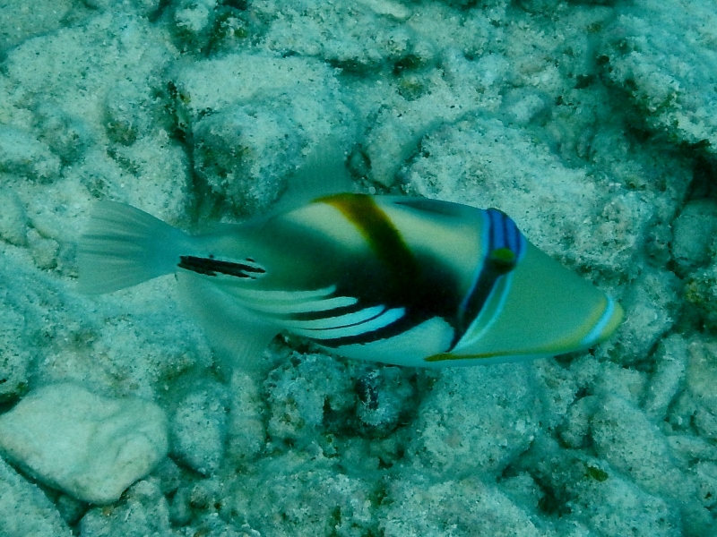
On the incoming tide large bluefin trevallies come sweeping over the reef in a large group, scattering as soon as they see our dark shapes, or those of a black tip reef shark cruising menacingly by. Another large fish flying solo is the fat lipped Titan triggerfish with its bright yellow markings and sharp rectangular teeth, visible through its gaping mouth. They look very strange, almost as outlandish as the much smaller Picasso triggerfish with its surrealistic markings and furiously beating little fins.
Picasso triggerfish
Another titan triggerfish
After four days of furious snorkelling we reluctantly leave Tahanea to go to Papeete, Tahiti, where we are dropping off Seb and Val. It has been awesome to have them on board and we’ll miss them, but at least we’ll all have fond memories of our most excellent snorkelling adventures.
After Rangiroa we head to Fakarava, the next largest atoll in the Tuamotus. Fakarava is famous for marine life, particularly the numerous sharks dwelling in the depths of the two passes linking the huge lagoon with the outside ocean. Because of its diverse marine life the atoll is a Unesco protected area.
Pink sand paradise
And sure enough, our week in Fakarava is another week of large marine animals.
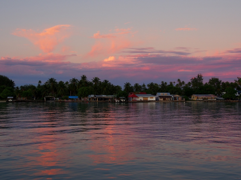
Fakarava north township
First up, on the way from Rangiroa to Fakarava we meet a group of rough-toothed dolphins – large shark-like grey shapes sloping from a triangular fin to a prehistoric reptilian head complete with a narrow crocodile-like jaw. They swim alongside the boat for a while, zooming ahead, cutting across the bow as if playing chicken only to abruptly slow down and do a few jumps, displaying their beautiful pinkish underbellies. We jump in and swim with them in the blue, blue water until they lose interest in our slow progress and veer away to find something more interesting to play with. We proceed to our next mammal encounter, a pod of pilot whales greeting us just before the pass leading into Fakarava atoll.
Rough toothed dolphins
Once inside the lagoon the water is thick with large underwater shapes moving swiftly, possibly rays but probably sharks. When taking the dinghy to shore we nearly run over a large nurse shark in the shallows – larger than our dinghy and unperturbed by our presence it flicks its long tail and glides on from under us to a few feet away where it remains, lurking by a rock undoubtedly hoping to make a bloody end to a tasty passing mollusc.
Boat hoisted out of the water in north Fakarava
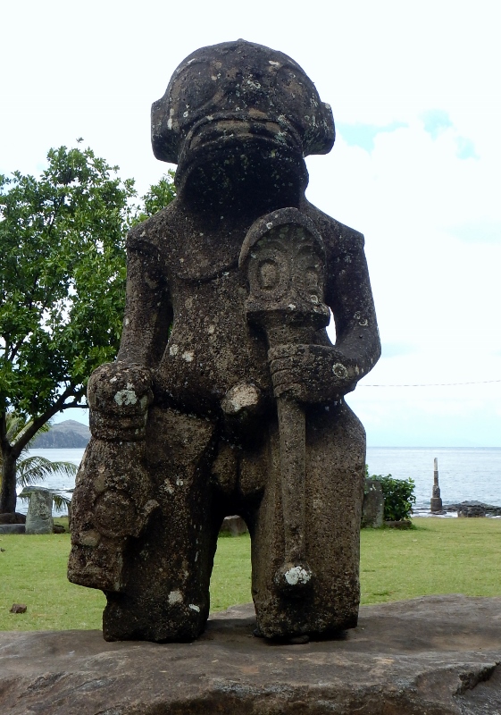
We stay a day by the main village and then head off to explore the many motu near the northern pass. Inspired by the locals, Val and David get into weaving using palm leaves and soon the boys are kitted out with skirts, belts, hats and armbands. Complete with a couple of stick on tattoos that Val brought they pose proudly for photos, pale Polynesian warriors wearing spiky sunhats, ready for anything.
Warrior
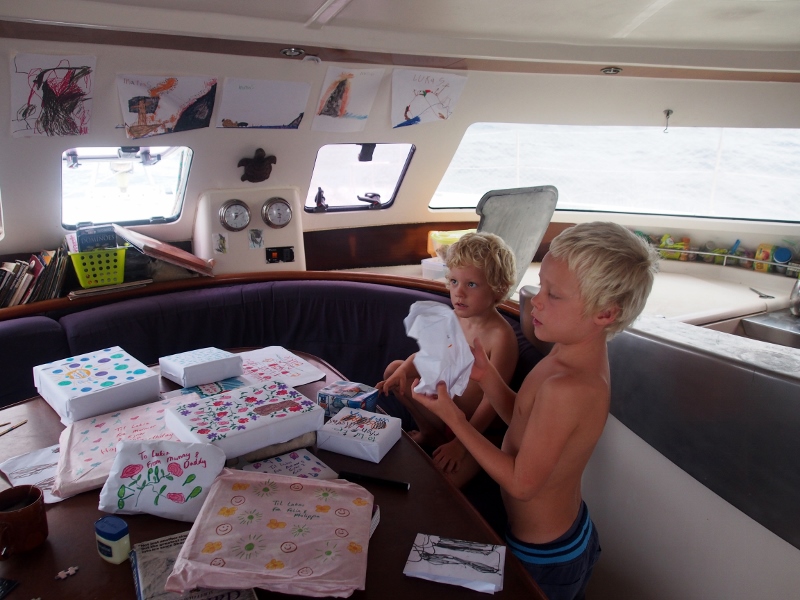
The boys have quickly taken to Val and Seb who play, paint, swim and chat with endless patience. Last week we opened up a new packet of coloured pens whose fine tips have allowed ever more intricate drawings and the boat is filled with Val and Matias’s sketches of underwater scenes complete with colourful fish and skin divers kicking themselves down to peer under ledges, as well as artistic renderings of the Droideka army slowly marching through showers of bullets towards staunch Jedi knights waiting, light sabres at the ready.
Lukie turtling on Val
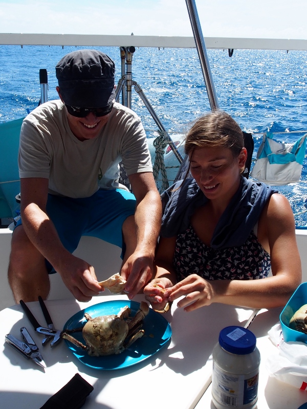
With Seb on board the seafood hunting has begun and during our week in Fakarava we manage to taste pretty much every type of crab there is on the atoll (the Unesco protection does not extend to crabs). Marine hermit crabs (yucky), land hermit crabs (better, but still not great) and large big-clawed Tupa crabs (pronounced the best yet). We find some rubbish on the beach which we use to construct a cray pot which we hope will lure in some better tasting dinner.
Yay, crab again!Getting into the Tupa crabs
We figure we need some seafood, because there is not much food to buy on the island. The three Magasins are stocked with a few expensive French tins as well as Danish pork liver pate, but fresh fruit and vegetables are limited to what comes in on the supply boats once a week, only to be snapped away immediately by vitamin C deprived locals. “Jeudi”, the locals say when we ask for anything fresh, Thursday. When the boat comes in. If we show up at 6 am. It is hard to eke out a living on an atoll – water is scarce and the roots of the ever present coconut trees interfere with other plant roots making little soil available for the growing of fruits or vegetables. On Rangiroa they imported soil from Tahiti to grow papaya trees, and we think of how hard it must have been for the original settlers to adjust to these arid, sunbaked atolls, used as they were to the rolling hills and fertile waterfalls of the Marquesas or Society islands from which it is thought they were excommunicated by warring neighbours.
Playing catapult
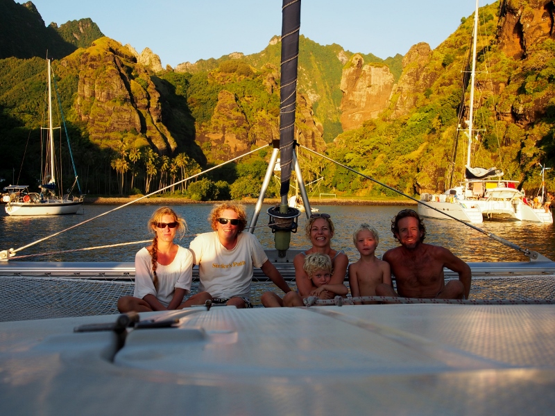
After a couple of days in the northern part of the atoll we head to the famous southern pass, where the waters are clear, the sharks plentiful and the Family Circus eagerly awaiting a delivery of fresh baguettes.
Water fun with the circus girls
At the southern end of the atoll there is only a small settlement, centered around a dive shop with adjacent accommodation for the many adventurers who come to dive the world class dive site that is the pass.
Seb and Val deep down in the Fakarava south pass
In the south everything is blue. Endless azure sky dotted with grey-blue fluff clouds grading to barely there egg shell blue at the horizon where a thin strip of white breakers or a small motu with yellow sand and green coconut palms briefly interrupts before the blue resumes in the water, turquoise over the shallow sand flats slowly morphing into the dark cobalt blue of the depth of the central lagoon.
Lagoon views
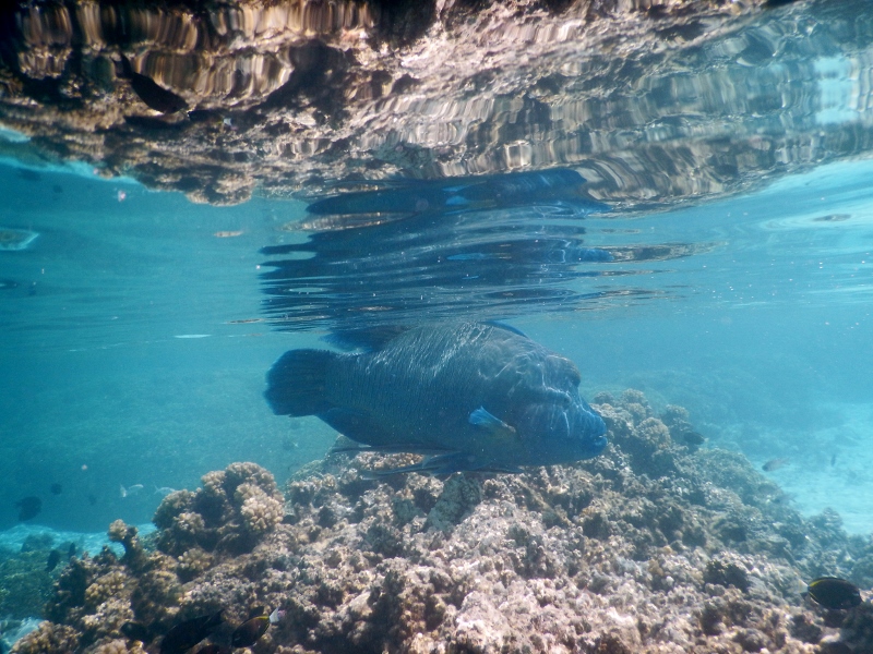
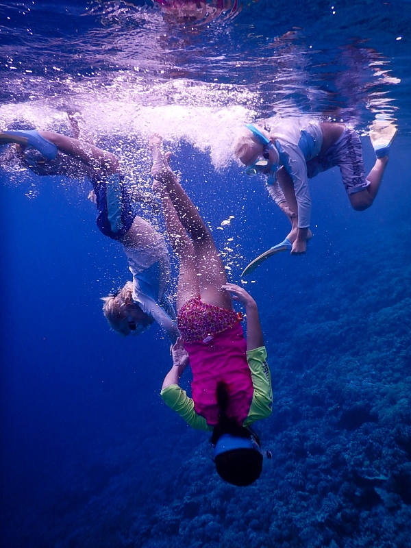
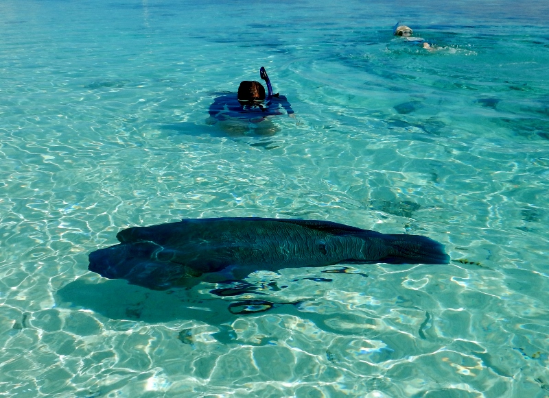
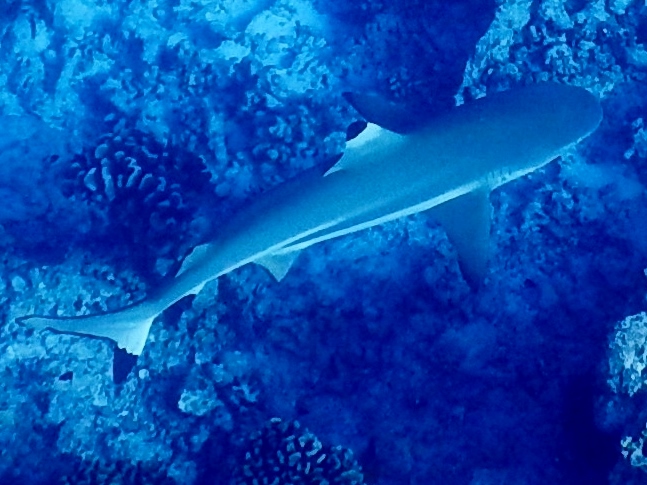
The pass lives up to its reputation, and we gorge ourselves on the best snorkelling and diving we have ever done in an amazing wonderland of infinite visibility. In the pass, the tide is either rushing in or out, providing fresh water for the corals that adorn the walls and bottom. To avoid ending up swept out to sea, we snorkel and dive on the incoming tide where the swift currents provide clear water; the ideal home for large pelagic fish and schools of 30+ grey sharks lurking in the depths. Up shallow, on the reef sides hang another 50 or so black tip reef sharks as well as numerous white tips. The sharks seem uninterested in us to the point of being almost friendly, and the children play in a shallow area near the dinghy dock called the ‘swimming pool’ where thousands of smaller fish hang out with about 20 black tip sharks. Also in the swimming pool is a group of five huge Shrek-like humphead wrasse who regard us nervously, their rotating chameleon eyes following our every movement. They are enormous, their lumpy round bodies powered by impossibly small trembly fins which they wave excitedly when they flee the advances of excited children.
The humphead wrasse – meeting a giant
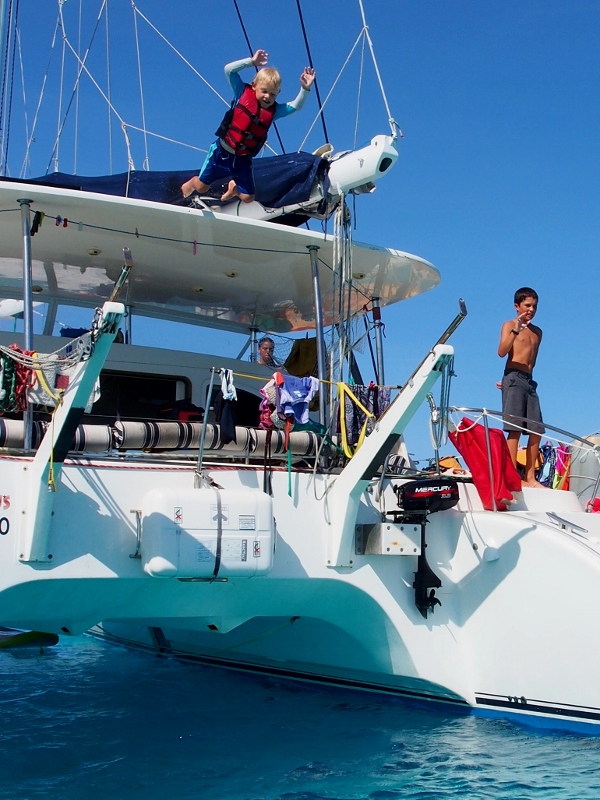
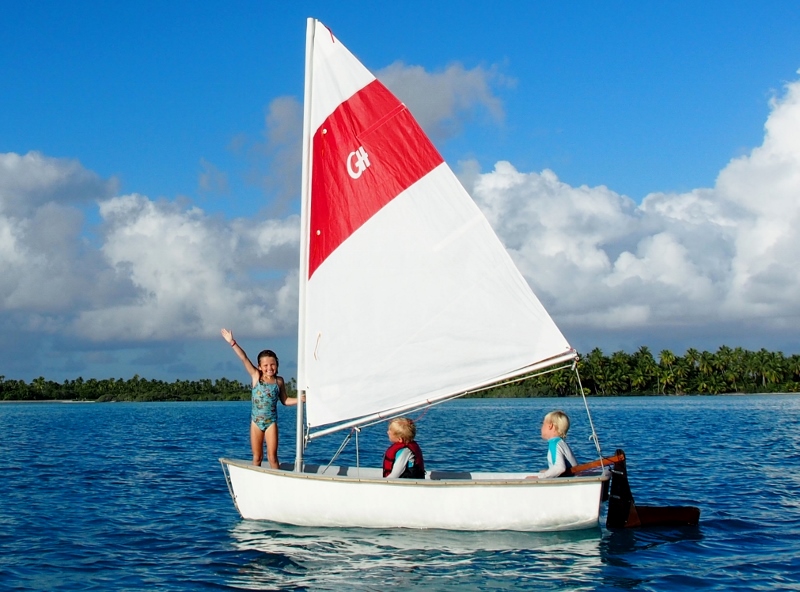
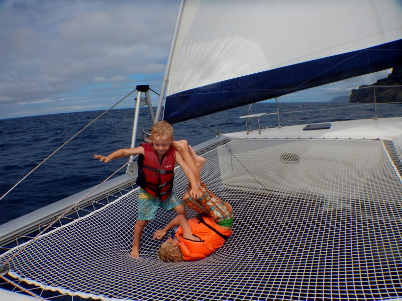
It is great to meet up with the Chris, Heather and the kids of the Family Circus again and Matias and Lukas are stoked to play with their youngest girls. They spend hours throwing sand on the beach, wading in the sea-cucumber studded waters, snorkelling the reef and jumping into the water from the rooftop of the Circus. Chris tows them around in the Circus kayak and after a quick sailing lesson Matias, Lukie and Alina inadvertently take off in a sailing dinghy on their own which they manage to sail back to the boat from the shore just fine.
Leaping off the roof of the Family Circus
One night we make a bonfire on a small motu, cooking freshly caught Tupa crab, potatoes and damper on the fire, the kids toasting marshmallows and running around excitedly finding ever larger hermit crabs, the grown ups lying back on the warm sand watching the reflection of the rising moon over the water.
Crystal clear waters, full of fishThe glorious humphead wrasse
Halfway through our stay a French film crew arrive – the guy who did ‘March of the Penguins’ is shooting a documentary about the Fakarava Pass – and we reckon they are feeding the sharks to improve the footage. Previously passive sharks suddenly take an interest, circling the boat aggressively on the anchorage, darting towards us when we snorkel. We get a bit spooked and exit the water swiftly after having to kick off a few lusty grey sharks. The dive shop says that the increasing swell on the outside of the lagoon is causing the currents to change, making the sharks leave the depths of the pass and scatter all over. Whatever the reason we’re out of the water and spend our last day at Fakarava playing on the beach, sailing the Family Circus dinghy and kitesurfing.
We leave Takaroa on Friday morning for the 24 hour sail to Rangiroa, the atoll where we will drop Sarah and Steve and pick up Seb and Val.
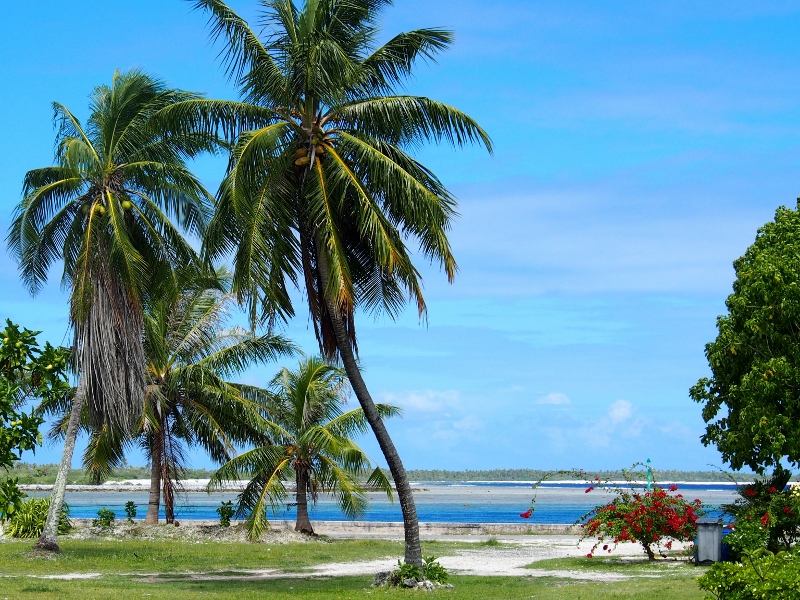
The largest of the Tuamotu atolls, Rangiroa is truly vast. Despite its name (rangi: sky; roa: long) it is clearly shaped like a foot, toes down, heel gently raised as if the giant it belongs to is daintily stepping over a small object. 1020 km2 in area, it is 75 km from toe to heel, 24 km from top to bottom and 225 km around its 240 motu. It is so large that the entire island of Tahiti would fit inside its reef, and once inside the lagoon we can’t see from the side of the lagoon we’re anchored on to the other.
Rangiroa is famous for sharks and other large marine life (dolphins, mantas) that come to play in the gushing waters of its two passes, and most tourists are here to dive. Frankly, there is little else to do here – the beaches mainly consist of coral rubble and there are no landbased sites to visit. The corals suffered severe bleaching in the late 1990s because of higher than normal water temperatures brought about by El Niños, but a quick snorkel in the lagoon convinces us that they are recovering.
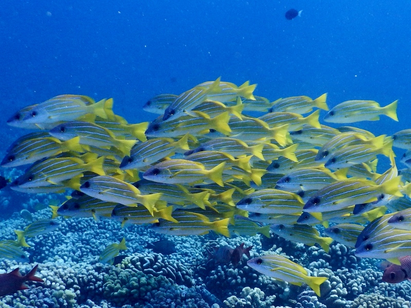
And so we snorkel and dive. The pass is a world famous dive site, with steep walls dropping off sharply, sharks cruising, schools of large Napoleon wrasse in the blue depths, giant eagle rays gliding past. The Aquarium, a site close to the pass is named for its superb visibility and abundant fish life; the kids spend ages swimming alongside baby blacktip reef sharks, peering into holes and seeing fat morays come out, mouths gaping in evil grimaces displaying sharp pointy teeth. Thick schools of snapper hang underneath the dinghy, barely moving when we dive down to say hello and Matias spends ages chasing the little unicorn fish that swim just below the water surface.
Matias and Val
We meet up with Karen, Jim and their daughter Jacinta again – we met them first in the Marquesas and the children are thrilled to catch up again. Jacinta, who is 8, has a hermit crab farm which she kindly brings to our boat for a play date, and the kids spend the afternoon staging crab races and otherwise fondling the scared little critters.
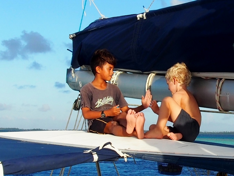
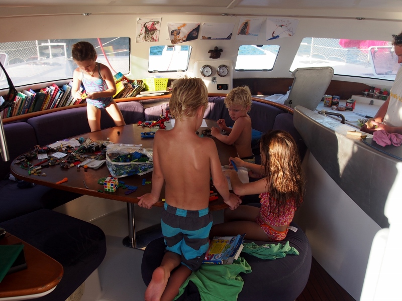
And then the time has come to say goodbye to Sarah and Steve. They have been with us for three months now, through ups and downs, passages and islands, winds and doldrums, fresh mahi mahi and corned beef. It has been awesome to have them on board and the kids are inconsolable when they leave. Thankfully Val and Seb are here with all the distractions of newcomers and spirits soon rise with Matias reading on his new kindle and Lukie playing the Zombie dice game that Val brought along.
Torturing hermit crabs
For our last night in Rangiroa we head to Ile aux Recifs on the other side of the lagoon, where raised coral outcrops provide the barrier to the ocean on the other side. The snorkelling here is picturesque and the beach lovely golden sand backed by a lush coconut grove. The trip across the lagoon is exciting, with a reef popping up out of nowhere in the middle, providing a quick opportunistic snorkel where we see eagle rays, sharks and lots of fish life. It is exciting to think that we might be snorkelling what used to be the top of a large volcanic island many millions of years ago, once standing as high as the mountains of Tahiti, now a submerged reef in the middle of a vast shallow lagoon. How time changes everything.
A stark contrast to the volcanic mountainous islands of the Marquesas, we are now in the land of low-lying coral atolls. And not only that – at 1500 km long and 600 km wide, with 77 atolls in total, the Tuamotus are the largest group of coral atolls in the world.
A reminder of the impermanence of our world, coral atolls are the last remains of tropical volcanic islands, ringed fringing reef encircling a sunken island. First proposed by Charles Darwin, the bearer of many news changing a immobile worldview, it is now universally accepted that rather than being fixed things, islands change over long timescales. First, a volcanic island forms from a hotspot spewing out lava until an island rises above the sea. If the island is located in the tropics, in an area of warm currents and clear water, coral reefs will form around the island. As it ages, the volcano sinks but the coral keeps growing, compensating for the subsidence of the volcanic layer below. Eventually the island is below sea level but the reef encircling it is still there. As it keeps growing, the rim of corals rise to the surface of the sea and parts of the reef broken down by waves and parrotfish start poking out of the water, becoming covered in white coral sand. Coconuts drift in and start settling, and other seeds arrive, giving rise to hardy, drought tolerant scrubs, whose roots trap further sand. Over long time scales the lagoon inside the islets (motu in Pamotu, the language of the Tuamotus) gets shallower as it gradually fills in with coral sand, until all that remains of the original volcanic island is a low lying sandy island surrounded by a reef.
Lagoon on the inside, ocean on the outside
As the name implies the Tuamotus are the atoll stage – low-lying (most are about 4-6 m above sea level) rings of islets, anything from a few to hundreds of metres wide, the ocean on one side and the calm lagoon on the other. Some of the lagoons are truly enormous, others small, some deep and others shallow. Some have one or more passes, channels through which treacherously fast tidal flows rush filling and emptying the lagoon twice a day allowing brave boaties to enter the lagoon, others have no access to the calmer waters inside deep enough to let through boats. Because of the fast-flowing currents and the infertile and dry sandy islands, early European explorers named the Tuamotus the Dangerous Archipelago, the Labyrinth, Islands of Dogs, Islands of Flies or, my favourite, which doesn’t sound so bad, Islands without End. Shipwrecks litter the coastline everywhere in the Tuamotus, inside and outside the lagoons.
Octopus on the run
It is thought that the Tuamotus were settled well after the Marquesas, possibly around 1000 AD by people from the Society or Marquesas islands in the big outbound wave of adventurers leaving at that time for Hawaii, Easter Island and the Cooks. Others believe that they were settled somewhat later by people who had lost territorial wars on the Marquesas. Either way, ferocious warfare was well developed and tearing the island communities apart when the Europeans turned up. Because of the bad press (anyone keen to immigrate to the Islands of Flies?) colonising powers with economic interests generally avoided the Tuamotus in favour of the more fertile Societies and Marquesas islands, and the atolls were left to Christian missionaries fighting for heathen souls, with a resulting wide diversity in faiths, including Catholic, Protestant, Adventist and Sanito churches.
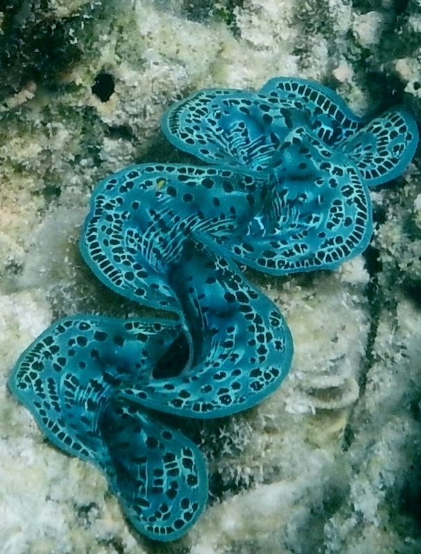
Small giant clam
Early post-colonial economic activities include copra plantations, pearl diving and mother-of-pearl production, which each saw a brief rise in population level before they collapsed. Unfortunately, the government found other uses for the islands when French nuclear testing in the Algerian Sahara was abandoned after the Algerian independence in 1962. Nuclear weapon testing started in the southern Tuamotu atolls of Moruroa and Fangatufa in 1966, and between then and 1996 193 nuclear bombs, or about 200 kilotons, were set off in these islands, including five megaton hydrogen bombs. Initially the testing was atmospheric, but in 1974 France bowed to international pressure to move the testing underground, a change all other nuclear testing nations had made 17 years previous. However, drilled shafts into porous coral atolls are not exactly what you’d call a safe nuclear testing environment (compared to, say, solid bedrock), and moving testing underground didn’t prevent a bad accident from occurring in 1979 when a nuclear device was stuck too shallow in a crevice where it had to be exploded, causing a huge tsunami which devastated Moruroa. After the wave receded a wide crack appeared on the surface of the atoll, and tests confirmed that the island was sinking rapidly, collapsing in on itself like a deflating swiss cheese. After this the French government moved the testing of larger bombs to Fangataufa atoll, and started underwater testing in the Moruroa lagoon.
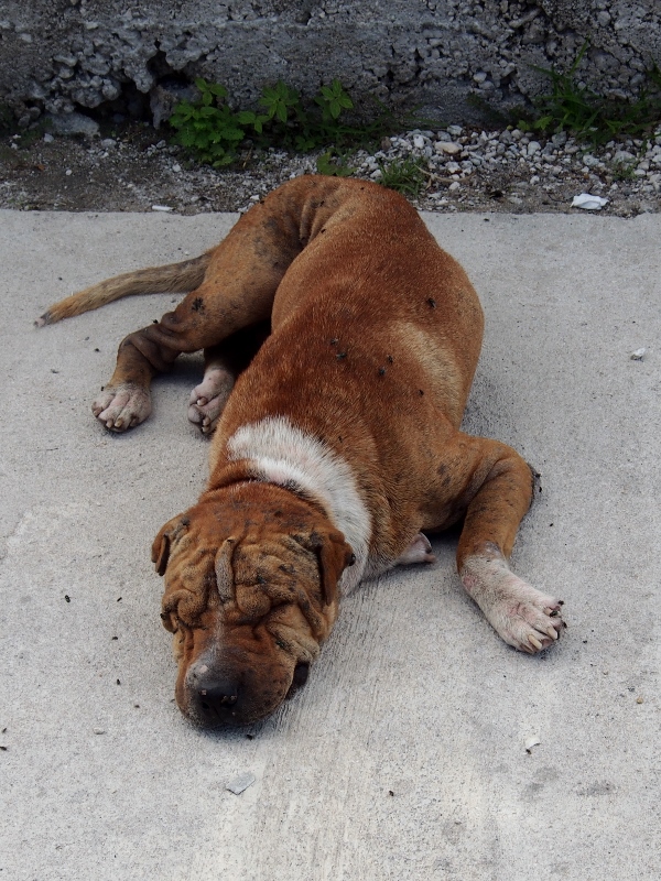
Dogs everywhere
The one benefit of the testing programme was an economic upswing for the islands and plentiful employment for locals for some years, with 130,000 islanders working on the two testing sites. The price to pay was high, though, with significant health effects in workers reported, and pressure groups have been fighting for decades with little success for compensation from the French government. For decades the government denied any ecological adverse effects, but in 1999 documents were released showing heavy contamination of groundwaters on the two testing atolls as well as the partial collapse of the atolls caused by drilling of shafts combined with pressure waves from explosions.
Hand signals sort all
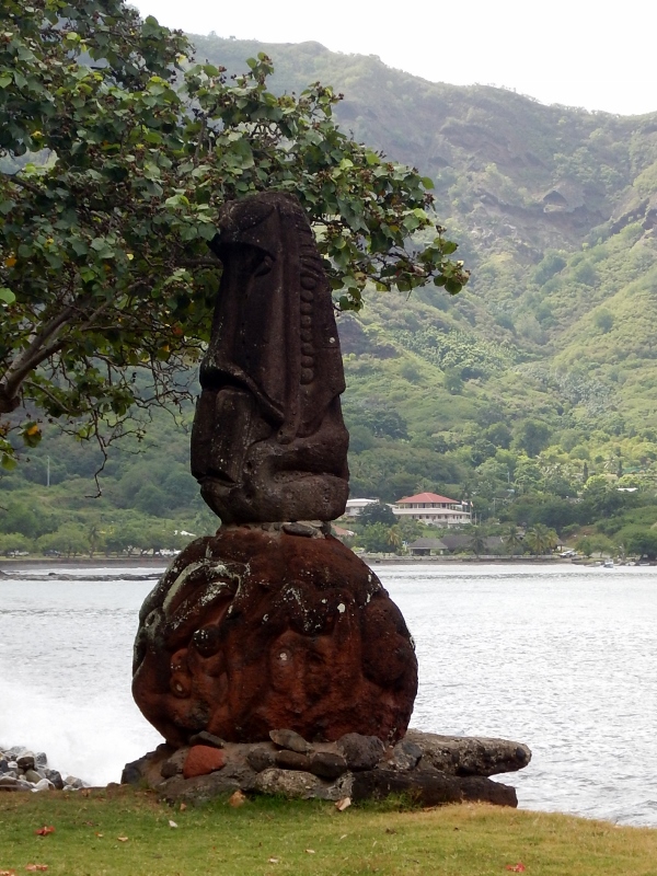
We arrive first on Takaroa atoll (taka: chin; roa: long), a peacefull atoll home to about 800 people well to the north of the dangerous nuclear testing grounds. It is a beautiful place, sandy motu of varying sizes encircling a large lagoon, islets covered in coconut palms separated by small gaps of shallow reef. The small town by the pass is recognisable some distance out by the tall red roofed church, and even offshore we can smell wood smoke and the tiare, a small white, beautifully fragrant gardenia, the symbol of French Polynesia.
When we arrive the waters of the pass are still running too fast for us to enter to the lagoon, and we tie up to the town wharf to wait for slack water (we had two estimates that both seemed to be wrong and in the end we deem it best just to sit and wait until we can see the maelstroms quieting and the gushing currents slowing enough for us to dare go through). In the meantime, we have a wonder through the town.
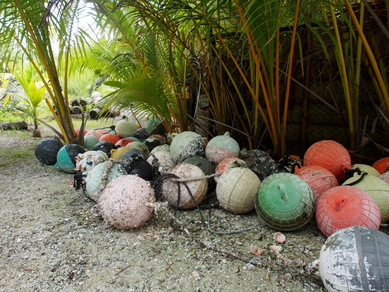
Like everywhere in French Polynesia the village is neat and clean, small wooden houses wrapped in flowery trees, from which French news and Polynesian pop music blare, mixed with the crying of children and the clucking of chickens. Chickens are everywhere as are dogs, the latter looking somewhat worse for wear, lying in the shade gasping and scratching their mangy coats, infested with flies. 95% of the population of Takaroa are Mormon, and we admire the well maintained little church, the centre of the town. The houses are shaded by tall coconut palms hanging heavy with nuts; from other trees hang colourful buoys used in pearl farms.
Pearl farming has been flourishing in the Toamotus since the 1980s, and although the price of pearls has gone down somewhat it still trumps tourism as a source of revenue on most islands. Takaroa is no exception and the lagoon is thick with buoys, traditionally causing cruisers to avoid entering the lagoon for fears of crashing into the farms or the buoys and ropes marking them. Apparently the pearl farming is slowing down enough for it to be safe to enter nowadays, so we decide to brave the pass, a long 30 m wide strip of deeper water (about 25 m) ending in a sharp dogleg bend just before a shallow 3 m sill situated right at the lagoon end. The currents are reported to reach 9 knots at the end and we can believe it – we have one unsuccessful go where we get all the way to the shallow sill, only to turn around when we see the large waves and insane current creating vortices of turbulence right at the end, after which we return to the wharf to tie up again and await lesser flows.
Eventually it calms down and we manage to get into the lagoon just before the flows turn and the breaking waves on the bar start up again, only going the other direction. In the lagoon is a maze of buoys, dotting the water with bright whites, reds and yellows. Submerged and partially obscured buoys are even in the marked navigation channel, so Steve and I stand at the bow shouting “Buoy!!” whenever we drive over one, only for David to slam the engine into neutral and nervously peer behind the boat, hoping that we’ve missed a major entanglement.
Eventually we reach our destination, a nice sheltered spot on the other side of the lagoon where we find depths shallow enough to anchor. We are greeted on the shore by the residents of the small bay, Robert and Maina Palmer, a lovely, inspiring and interesting couple who we manage to donate the last binbag of mahi mahi to. A retired couple who have returned to his place of birth, he is 82 and she 70. The son of an English trader and a Takaroan wife Robert has had an interesting life so far, living all over the world, doing all sorts of jobs. He lived in South Australia for a while diving for abalone (“Those were the good days – so much money to be made!”), in New Zealand for a while with his Maori wife, in Europe and in the US. Maina is a retired globetrotter as well – she used to work as an air hostess with Air Tahiti and was once the Pacific Golf Champion – she has travelled all over and lived in both Indonesia and Mexico with her former husband.
Robert, Maina, Sarah and Steve
Their family is now living mainly from pearl farming, but Robert tells of bad harvests and limited growth for the last two years followed by a total collapse of the industry this year. All the buoys we have seen are apparently relics, left there in the hope of a miraculous recovery, with no viable farms left. As expected the collapse was an economic disaster for most of the population, and Robert recounts how the initial population of 400 people boomed to 2000 at the height of the pearl farming only to drop to the current 800, with several families now facing financial hardship, forced to take up the heavily state subsidised (but far less lucrative than pearl farming) copra production or simply sit and pray that the oysters will recover.
When asked what caused the collapse Robert cites pollution caused by the rise in population. “People don’t look after the waters”, he says. “They throw in batteries, oil drums, and now we are paying, our pearls disappeared”. Apparently some French scientists came out from Paris last year to figure out why the pearl farming had collapsed, and Robert says they blamed pollution. It has happened to other islands too, but Robert reckons some are still good, and his family has moved their pearl farming to another island where they also own land.
He and Maina show us around their beautiful property, delightful open houses sat directly on the coral pebbles, a kitchen half-house overlooking the lagoon backed by lush gardens watered from their ample rainwater tanks with huge solar panels at the back fuelling their electricity needs. It is peaceful , cats and dogs lying in the shade, pearl shells hanging in mobile formations from the frames of the open houses, coral encrusted buoys decorating the trees.
The view from the open kitchen
White tip
We ask them about the Tuamotu independence movement, and Robert calls them fools. “I’ve been to Vanuatu”, he says. “I’ve seen how poor they are, how much they struggle. Us, we get free education, free medical treatment – we get so much from France”. They tell of once-yearly free flights to Papa’ete for all French Polynesians; three day comprehensive medical check-ups in the hospital there and of the free treatment he received in Paris when he suffered an illness, where he and Maina were put up in hotels and provided with money for food and other living expenses in addition to receiving top quality medical at an esteemed Parisian hospital. They explain that copra production is subsidised by the government in an effort to stop emigration from the atolls to Papa’ete. There have been costs, though – they are much saddened by the almost complete loss of Pamotu, the language of the Tuamotus, and admire that the Marquesans managed to keep their language alive. Although taught in schools now, when Robert and Maina went to school they would get a beating if the teacher heard them talk in Tahitian or Pamotu; they were only allowed to speak French, and would learn nothing of their own history.
Redundant pearl buoys
They are amazing people and it is a real joy to meet them and to hear more about their lives, the lives of their families, and the changes they have seen on the islands during their lifetime. We have read about the incredibly clear waters of the Tuamotus and the beauty of the corals, but so far we’ve found the lagoon coral to be quite damaged, the fish terrified (of us? sharks?) and the visibility rather poor. Wondering whether the decline in the condition of the coral reef is related to the collapse of the pearl farming industry we ask Robert how the lagoon used to be, and he tells stories of crystal clear waters, brightly coloured corals, giant clams everywhere and an abundance of fish and shellfish. The damage we’ve seen could be caused by bleaching (when coral reefs become stressed the coral polyps eject their symbiotic algae, causing bleaching), which could be a result of storms, tsunamis or rising temperatures. Whatever the reason, the good news is that Robert reckons that the reef is coming back, and the latest growth does seem healthy, with small giant clams re-establishing and fish life returning.
White tip
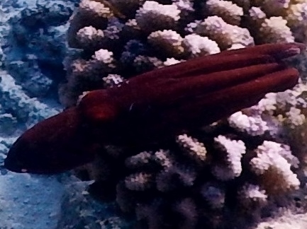
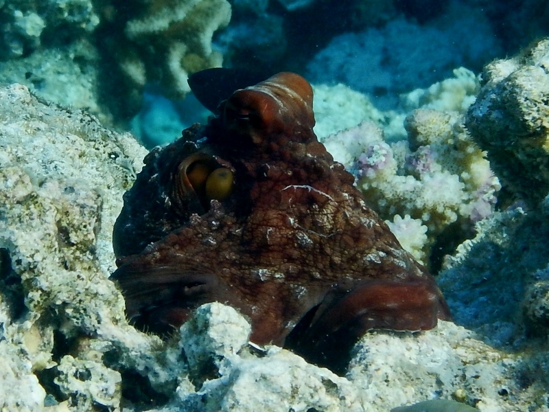
After a couple of nights in front of Robert’s house, we tire of our tame existence and leave for the pass entrance to take the kids for a shark snorkel. Armed with a Hawaiian sling for protection, we bravely jump in and immediately see lots of shark – sinister looking white tips, beautifully striped black tip reef sharks, elegantly billowing long tailed tawny nurse sharks and large dangerous grey reef sharks. Wearing a lifejacket for the drift snorkel through the pass, Lukie keeps lifting his head out and calling to Sarah and Steve on the boat: “A blacktip shark!! And another, HUGE, grey shark!!!” Never before have I seen so many sharks; we have to keep telling Matias to stick with us, as he is swimming further and further away on the reef top with sizeable sharks lurking behind him. On the steep sided reefs lining the pass are healthy corals, giant moray eels and hundreds of different colourful fish. In amongst the rocks are cunning looking octopuses pretending to be rocks, recognisable only from their rounded eyes sticking up from the grey reef. If we linger they give up their disguise and turn an aggressive maroon, lifting a few arms, trying to look fierce, poisonous or both, before legging it a few metres, settling down and rapidly turning into a rock again.
Angry octopus
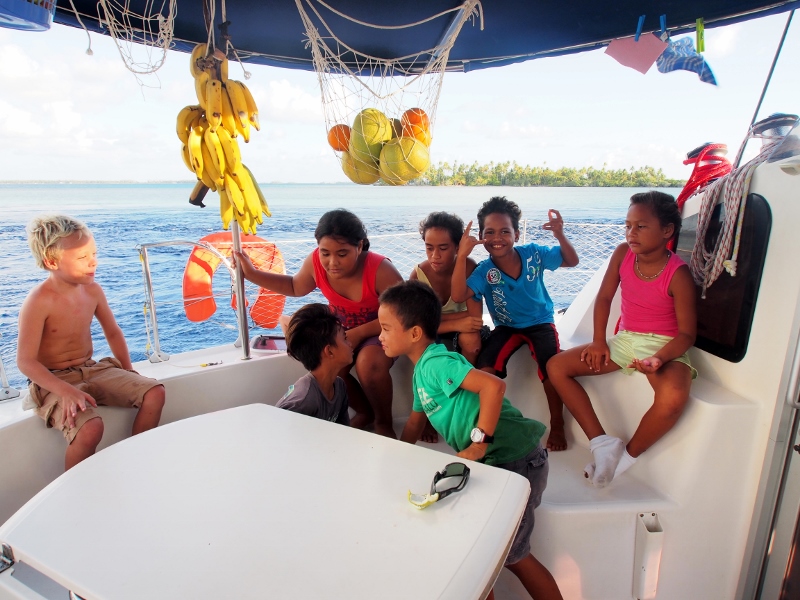
When we get back to the wharf a large group of children have gathered to watch us and we invite them on board and ply them with bananas and bubble gum as they ask questions about where we’ve been, where we’re heading, and try out their best school English. It is fun to meet them and they reluctantly jump off the boat when darkness falls, heading back to their homes and leaving us to our dinner in the sunset.
We leave behind a rainy Nuku Hiva, but we’re happy we went back to Taiohae Bay – we now have all things fresh that the heart can desire, what you would expect to take away from such a lush and fertile paradise. In fact we are better stocked than we’ve ever been, carrying baguettes, grapefruits, pumpkins, courgettes, aubergines and parsley, as well as cucumbers, tomatoes, carrots and bananas.
The crossing is pretty uneventful apart from Catching the Big Fish, which occurs around lunch time on Day 1, when an enormous mahi mahi bites and starts its fight for survival. It takes about an hour to reel him in, and as he gets close to the boat he dives under and wraps himself around the rudder, so David has to strip down and jump in to untangle the line. It takes a massive effort to get him on board, and once cleaned we have two large binbags full of fish – he didn’t fit any of our tubberware.
So we supplement the fresh fruit and vegetables with copious amounts of mahi mahi, and by the time we arrive three days later, we have consumed just over half the fish in a variety of forms including plain fried fish, fish soup, fish salad and fish curry. Sarah, who has never been a big fish eater, puts up a brave face on the last night as she picks past the fish in the curry, choosing to focus on the snake beans instead.
The children are accustomed to passages now. Apart from the usual involved Lego games, Matias spends much time playing chess on the tablet and reading on my kindle, whereas Lukie engages in his favourite activity of dragging out the Encyclopaedia of the Sea and asking questions like ‘Which shark is the biggest in the world?’, ‘Is a baby fish smaller than a dwarf goby?’ and ‘What’s your favourite whale?’.
At the end of Day 2 we have to slow the boat down to ensure that we don’t approach the island of Takaroa in the dark – we can only enter the pass through to the lagoon at slack water during daylight hours, so we hold off waiting for dawn, admiring the orange rays of sunrise that illuminate the low shapes appearing out of the ocean.
Hej Britt, hermed et stort tillykke med foedselsdagen fra alle os paa katten Bob. Vi haaber du har haft alletiders dag. Kaerlig hilsen David, Malene, Matias og Lukie.
Nuku Hiva is the last island we visit in the Marquesas before setting off for the Tuamotu archipelago where we have to drop off Sarah and Steve, and pick up Seb and Val, on 9 May.
Nuku Hiva is the largest island in the Marquesas, with the largest population of humans and possibly sharks. Compared to Hiva Oa the places we visit are easy access, that is, if you don’t mind a shark or two on the way in.
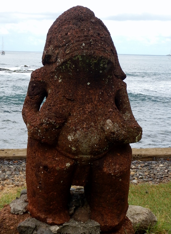
The main town, Taiohae is beautifully set in a large sheltered bay lined with steep, dark green hills plummeting down onto the narrow coastal strip that is the town. As usual old has been built on new, with large tiki lining the beach at intervals behind the smart rock revetment that keeps erosion at bay, a beautifully flower-filled graveyard poking out above the ancient monuments. The town church is situated on a paepae, an old rock foundation on which the me’ae (temples) used to be – it was commonplace for the missionaries to appropriate old sites of reverence and turn them into churches, a single effort to achieve the double goal of stamping out heathen worship and save on new foundations. Just behind the church is a huge banyan tree, in a pit under which live prisoners used to be kept until required back in the days of rampant cannibalism.
Nowadays the only human eaters are sharks – and they are everywhere. On the anchorage large fins circle the boats, and on the wharf the early morning fishermen cause a feeding frenzy by throwing the remains of fish cleaning in the water. We watch fascinated as large black-tip and grey sharks fight over the fish carcasses, fins thrashing, jaws snapping, blood spreading.
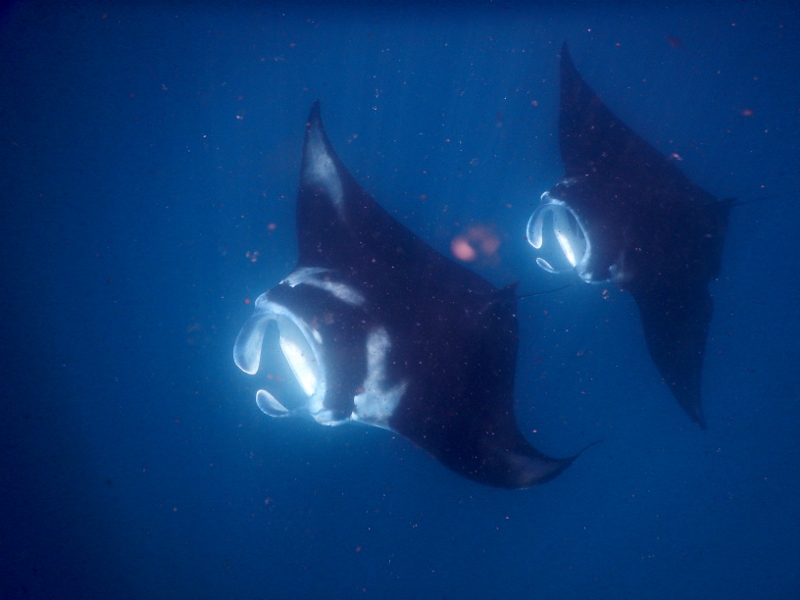
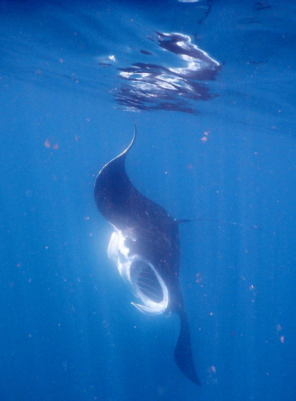
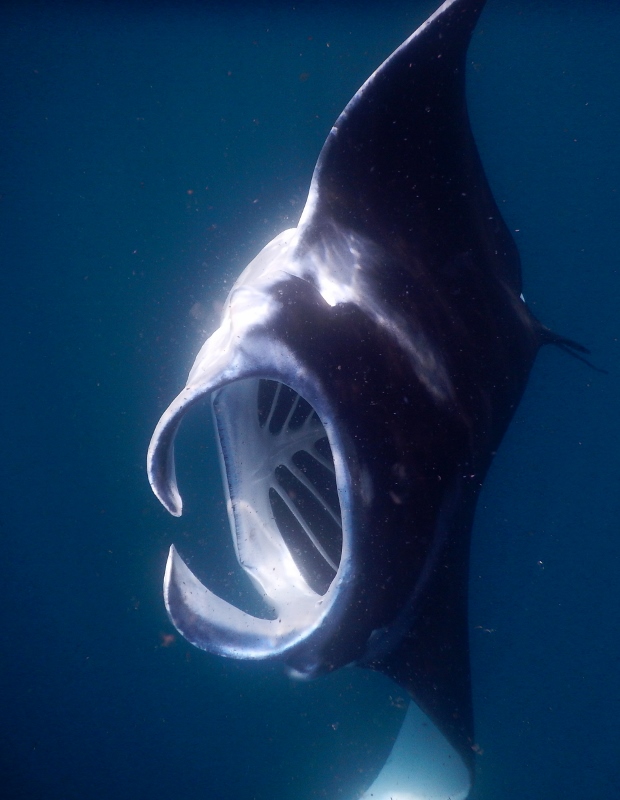
As we leave the southern coast to go to the north coast to a beautiful anchorage in Anaho Bay we meet a school of manta rays and I jump in the water to scope them out, resolutely shoving any thoughts about the morning’s shark feeding frenzy 300 m away at the wharf to the back of my mind. At first there are just two mantas, but soon I’m surrounded by six, elegantly cruising up and down, unperturbed by my presence. Having a whole flock to hang with calms my nerves – surely there are safety in numbers, even if the others are a different species – and I call in the others. The kids are whooping with delight as the huge rays glide up towards them exposing their gaping mouths flanked either side by large cephalic lobes which gently push the water through to a seemingly thoroughly hollow interior (where is its gut?!?), only swerving at the last moment as they turn upside down, beat their wingtips and sway back down into the depths. They are graceful and majestic, beautiful contrasts of black and white, and it is incredible to be swimming with a whole group of huge animals. In the end we reluctantly exit the water and get on our way, only to see a large hammerhead shark cruising by when we round the corner.
Further up the coastline we are treated to dolphins riding the bow wave, clicking and squeaking as they go. We stop the boat and I jump in to swim with them only to have them dive away, out of sight. When I get back to the boat the others tell of a huge grey shadow that was following me, and I wonder what it was – a whale? A giant manta ray? A huge hammerhead shark? – and whether it was that or my presence that caused the dolphins to dive.
After all these imagined near brushes with death it is almost a relief to anchor in Anaho Bay, where we’re surrounded by astounding landscape above the water and a peaceful shallow coral reef lining the bay under the water. With the plunging depths and wave exposed shores there are not many coral reefs in the Marquesas, and those that survive in sheltered bay are only shallow because of the highly productive and murky waters. Anaho Bay is one of the few, and beautiful it is – lots of orange sculptured coral heads with pretty coloured fish darting in and out of crevices and caves, gentl gliding turtles, delicate nudibranches and spiky shells, a feast for the eyes. Probably still sharky, but at least it is shallow and we can see the bottom. The Family Circus are here too and the kids play on the golden beach in the dumpy waves, finding stray kittens, sticks for swords and coconuts in the well-kept coconut grove behind.
But alas, we have to leave this paradise to get moving towards the Tuamotus, Seb, Val and a plane for Sarah and Steve and early on Friday morning we try to pull anchor only to find that we’re snagged on a rock, so at 6 am we’re in the water trying to figure out how to release the anchor chain – a nice refreshing way to start the day. We manage to get free and reluctantly head for Taiohae for a last provisioning, leaving behind the Circus whom we dearly hope to meet again in the Tuamotus.
Melon heads
The day brightens when we meet a pod of melon-headed whales – about 30 or so, who excitedly jump in our bow wave, turning their heads from side to side displaying big toothy grins as we sit on the trampoline, transfixed and soaking wet from the frequent waves crashing over the bow.
Melon jump
Further down the coastline we catch a skipjack tuna, and when we hang the cleaned carcass from the back of the boat a hammerhead shark promptly shows up to gulp it down. What an end to our visit here!
More melon funHammerhead coming for fish carcass
Ahead lies a 3-4 day passage to Takaroa island in the north-eastern Tuamotus, followed by another 1-2 day trip to Rangiroa where we’ll meet Seb and Val. The Marquesas have been incredible, truly exciting, different from anything we’ve ever seen before, and we are sad to have to leave so soon – but new adventures beckon, and a bit of coral reef atoll makes an exciting change.
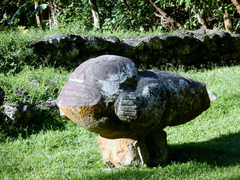
Hiva Oa is intriguing. It is the second largest island in the Marquesas group and the most important island of the southern Marquesas. It has numerous archaeologically important sites of ancient me’ae (temples) where huge tiki representing ancestors of particular importance continue to impart mana and special protection against misfortune to their descendants. The island rises sharply from the surrounding ocean, all angles, sharp peak, black volcanic rock and inaccessible land beyond.
Gauguin the famous impressionist painter lived here for a couple of years after he had to leave Tahiti following severe reprimands from the Catholic church because of his numerous relationships with under-age girls and his drinking escapades. His habits didn’t change on a new island and the fraught relationship between painter and church continued in Hiva Oa until his death from drinking in 1903 when he left behind his 14 year old mistress.
It is a beautiful place, just quite hard to get ashore.
Our initial impressions are not particularly favourable. It is pouring down when we come into the anchorage off the main town of Atuona on the southern side of the island, the tall mountains behind the town covered in impenetrable cloud. The main anchorage is behind a breakwater but when we motor in there looking for a spot we are turned away by several agitated boaties worried that we will snag their lines – the anchorage is very tight, the swell is big, and many boats lie with a stern anchor to keep them firmly bow to the swell. A wild looking Canadian man shouts that he doesn’t want us to anchor near his boat as he has a lot of line out, sweeping his arms wide as if to indicate his line could be anywhere around him. A second later the skipper of a huge French catamaran informs us he has 80 m (!) of chain out and that he doesn’t want us anywhere near. Space is obviously at a premium and because we won’t roll as much as a monohull we decide to anchor somewhat away from the other boats outside of the breakwater, in what proves to be a sickening roll.
It continues to rain throughout out stay here. We have to go to town to check in, a 45 minute walk to the Gendarmerie where they are friendly but firm, informing us that because the children are New Zealand citizens we need to either pay a deposit of thousands of dollars or come up with a one way ticket for each of them to New Zealand. The rest of us are OK because we have European passports. So we do a bit of shopping for fresh produce and head back to the boat to go online and buy tickets. Laundry prices are astronomical here so the following day I spend four hours handwashing our sheets, towels and clothes before we head off to sunnier shores.
Bob on anchor
We find a more pleasant anchorage off the small island of Tahuata just south of Hiva Oa. It is great to get some sunshine so we can open the hatches and go for a swim. The reef around Ivaiva Bay where we’re anchored is full of colourful fish and even sports a small resident black tip reef shark which follows us around looking hungry. We are quite keen to head to the main village a bit further south on this little island to look at some of the wood carvings which the island is famous for but the anchorage proves a nightmare, with the valley acting like a funnel, channelling winds of 35 knots through the bay. The anchor holds but someone has to stay on board in case we drag – the winds are so fierce that there a lot of pull on the anchor. Sarah, Steve and I try to go ashore, attempting to land the dinghy on the copra dock which is full of fishing boats tied on with stern anchors holding them off the concrete slab which is awash with big waves. We try a stern anchor but it snags and Steve has to dive down to get it free, after which we decide that we simply weren’t meant to go ashore. Just after we return to the boat a particularly strong gust of wind causes the boat to jump, the anchor clearly lifting off the bottom, and we quickly haul it up, leaving this hostile bay to look for somewhere easier to anchor and go ashore.
Only there aren’t really anywhere easy to go to. We are keen to see the famous ruins and tiki of Hiva Oa, and so head back there to go to the northern shores to visit a number of bays. We manage to go ashore dragging the dinghy through sizeable surf at Hanamenu Bay, a quiet spot mainly known for a natural spring running into a crystal clear pool just behind the beach. It is a lovely place, and we thoroughly enjoy a good wash in the pool, the kids playing all over the fruit tree filled garden before it is time to get salty again attempting to launch the dinghy through the surf on the beach.
The next bay over, Hanapaia, is a flower filled wonderland, the fragrance from the fruit trees and flowers filling the air and lifting our spirits out on the anchorage. Despite the odds, we manage to get ashore onto the copra dock, leaving the dinghy to bounce up and down on the waves. Once in the villagewe quickly meet a little boy who plays energetically with Matias and Lukie, while we chat to some of the locals. Most people are not fluent in French – it is mandatory in school, but 90% of French Polynesians speak their local version of Maohi at home, a language very similar to Maori. It is great to learn some phrases, and the comparison to Te Reo Maori provides a great talking point as we hesitantly try out a greeting or two. Before long the kids are enthusiastically shouting Ka Oha (the local Kia Ora) to passers-by. Chickens, pigs, goats and horses everywhere, with the odd cow looking up from the vegetation occasionally. Everything is exceptionally clean and tidy everywhere we go, with neatly mown lawns, carefully planted flower bushes and trees interspersed with fruit trees bending heavily under the weight of the ripe fruits. A friendly lady from the village gives us pamplemousse (grapefruit) and drinking coconuts, refusing to take any payment.
Behind the villages are large coconut plantations providing the nuts for the copra production which is subsidised by the French government in an attempt to keep people from the outlying areas of French Polynesia migrating to Tahiti.
The next day we head onwards to Puamau Bay, the site of the famous Iipona archaeological site. It proves impossible to land the dinghy anywhere in the bay – the copra landing is gnarly, with sharp black rocks poking through the waves smashing down onto the slippery concrete wharf, and the beach has 3 foot waves crashing onto it. So David drops Sarah, Steve, the kids and I behind the surf and we bodysurf in, waterproof packs on our backs, waves crashing down on top of us. The me’ae is worth it, though, with five large tiki situated atop several platforms carved into the steep jungle clad hill. The tiki represent the chief Taaiki and his wife as well as other ancestors of great mana, who oversaw the rituals and meetings carried out at the site. Always keen on the macabre, the kids are thrilled to be in a place where human sacrifice used to take place. It is an eerie site, peaceful yet sinister, the statues with their timeless and menacing glare making us feel like unwelcome intruders. The local tradition has it that tiki have large powers, with endless misfortune befalling those who choose to ignore their wishes by relocating them without blessings and the like. Although we are not doing anything of the kind we feel a bit out of place and draw a sigh of relief as we walk down the road towards the sun filled valley in front of the site.
The marine life is prolific here, with dolphins greeting us at the entrance of one bay, a juvenile manta ray in another and melon headed whales along an arid stretch of coastline. The water is thick green with plankton and the visibility poor, and this combined with the many sharks we see makes us hesitant to swim. As we sail around Hiva Oa we are forever amazed by the landscape – from the arid desert like eastern end of the island to the lush tropical green peaks of the western end. Waterfalls are everywhere and the coastline is dotted with caves and blowholes, with white foamy water shooting metres into the air as the waves smash down. Strange landforms are everywhere, tall columns of rock rising from the sea or land, resembling stout severe faces keeping a sharp lookout to sea. It is impossible the catch the beauty on photos but we never stop trying – what a place!
What a place to make landfall after crossing the longest leg in the Pacific! The island of Fatu Hiva rises vertically from the sea, jagged hillsides softened by vegetation with razor back ridges of sharp rock poking out. Everywhere you look there are sheer rock faces and tall columnar rocks resembling figures and faces, poking out like guardian gods overlooking their island. It is easy to see where the inspiration for the famous petroglyphs (stone carvings done on rock faces) and tiki (statues carved from stone or wood) came from – nature here is full of them.
About 1400 miles northeast of Tahiti, the Marquesas are the northernmost part of French Polynesia. There are 10 main islands in the Marquesas, lying in a 350 km chain from north west to south east. Fatu Hiva is the youngest and southernmost of the islands; at only 1.3 million years it is a mere baby compared to most other landforms in the world. Surrounded by water depths of 3000+ metres the Marquesas were formed in huge seabed volcanic outbreaks, the islands rising vertically from the bottom to the sharp tips of the numerous ridges of their volcanic shapes. I have never seen a landscape so incredible, young, steep and sharp, with none of the rounded edges that older age and weathering bestows on mountainous islands. Because of the height of its volcanoes (the tallest of which is 960 m above sea level) Fatu Hiva gets a lot of rain for the Marquesas and I imagine that its rocks will soften in a couple of million years as the water takes its toll.
We are anchored in the ‘Baie des Vierges’ (Bay of Virgins) off the small town of Hanavave. Originally named ‘Baie des Verges’ (Bay of Penises) by the first French settlers to celebrate the large phallic rock protrusions that line the bay the name was later changed by missionaries keen to suppress any improper thoughts in this remotest of locations.
Madonna or penis?
Fatu Hiva used to support quite a large population, but nowadays there are only about 600 people on the whole of the island, half in Hanavave and half in the southern village of Omoa. The island was made famous by Thor Heyerdahl in his book ‘Fatu Hiva’ where he chronicled his failed attempts to live off the land in this tropical paradise with his young wife Liv (she ended up getting elephantitis and nearly died before they aborted the attempt and went back to Norway).
The Marquesas were known as ‘Te Henua Ehana’ (the Land of Men) by the Maohi (eastern Polynesians) who first settled on them around 300 BC from Samoa. The Marquesas islands were amongst the first to be settled in French Polynesia, and it is from here that subsequent settlement of Hawai’i, Easter Island (Rapa Nui) and the Cook Islands, and onwards to Aortearoa, New Zealand, occurred. As a result, the Maohi language is closer to Hawaiian, Cook island and Maori than to Tahitian.
The first Europeans to find the Marquesas were the Spanish, with Alvaro de Mandana spotting Fatu Hiva in 1595. He named them Las Marquesas de Mendoza after the wife of his benefactor the viceroy of Peru, and the Spanish continued to keep the island group a secret to prevent the English from conquering them. Living on small islands with limited resources overseen by forbidding gods had turned the Marquesans into one of the fiercest communities in the Pacific and their heavily tattooed warriors practised both cannibalism and human sacrifice. Predictably, the first encounter with the Spanish was a disaster and Mendana killed Marquesan people on sight after an initial unfortunate incident with some warrior canoes, leaving behind a bloody trail of more than 200 dead Maohi. Subsequently whalers introduced syphilis, alcohol and smallpox, and of the initial population of about 80,000 Marquesan Maohi in 1800 only 15,000 remained when the French took over the Marquesas in 1842. Today the population of the Marquesas is about 8000, mostly of Maohi descent.
All over the islands are scattered archaeological remains, mainly of me’ae (temples), tohua (meeting places) and male and female tiki representing important ancestors that ruled before Catholicism took hold.
Kids at play
On Fatu Hiva we meet the ‘Family Circus’, two parents and their six kids travelling around the world on their 47 foot catamaran. We join forces to hike to the waterfall behind the town of Hanavave and Lukie and Matias become great friends with Alina and Amaia, who are 6 and 7. The following day we all take their boat over to the other village on the island, Omoa, and some of us walk back to Hanavave over the imposing ridges, gorging on magnificent views of the island and the sheer cliffs. Walking out of town is like entering some half-forgotten jungle out of a Tintin cartoon, where cannibals roam and carved statues representing stern ancestors lie scattered on the forest floor next to altars used for offerings to appease the gods. It is lush and green, all but the steepest hillsides covered in grasses, trees and ferns, curling vines climbing up and up towards the sun. In the two small villages and along roads and paths colourful flowers and fruit trees are everywhere – giant pomelo grapefruits, starfruits, breadfruits, rambutans, mangoes, cashews, bananas and impossibly tall coconut trees towering overhead. Coconut lies drying on roadside racks everywhere, waiting to be turned into copra to be used for livestock feed or coconut oil production.
Coconut drying
A family is offering fruit for sale at the wharf but it appears they don’t want money for their wares, instead preferring to do trade. I guess money is not that valuable in a place like this; what would you spend it on? The woman wants hairbands, mascara, perfume, lollies, sunglasses or flip-flops, whereas the men ask for fishing hooks and line, snorkelling masks and fins, or wet weather gear for fishing. Sarah and Steve visit a local carver, and find that his beautiful statues can be part traded for goods too only we don’t have any of the things he wants so they settle for a cash price for a magnificent tiki.
Just after we arrived
After three days at Fatu Hiva we set sail to go to Hiva Oa on 20th April – it is time to check in, hoist the French flag and do a bit of grocery shopping.
Day 15 is Lukie’s birthday. The clocks changed overnight (our third change so far on this passage), so the kids are up bright and early, 5 am new time, eager to start the celebrations. During the night we were literally pelted with flying fish and Lukie has one fried up for breakfast, which he devours in one big gulp.
At morning tea time we have the Hulker cake, which looks awesomely scary, orange luminous eyes staring from a skull like darkened face, blood dripping from his claws, fangs bared in a wicked snarl. After that there is a complicated treasure hunt for lollies, followed by painting with the new water colours from Grandpa and Gu.
Hulker cake!
Lukie ordered mahi mahi for dinner, so we got two lures out and the fridge on in anticipation. Failing that, Steve says he knows some pretty good recipes with corned beef…
The chart plotter is beginning to show ‘Time to Arrival’, a feature which switches on when it reckons there is hope that we’ll eventually get to our destination, and its appearance lifts our spirits to a level befitting those that have just eaten an entire jar of nutella disguised as a Hulker.
We feel good – the kids are happy, the sun is shining, and there is new Lego to build. At the end of Day 15, we’ve logged 2433 miles, with 557 miles to go, we’re definitely getting closer. Day 16
The sunny conditions continue on Day 16, but the batteries remain stuffed – they are clearly on their way out, and no amount of charging is going to fix them now. They’ll likely last until we get to the Marquesas, but probably not much longer, so we’ll have to seek out replacements at the earliest opportunity.
Like the batteries so the crew – everybody is exhausted, apart from the kids who can sleep as much as they like. We hear from the network that a boat we know has lost their autopilot only a couple of days out from the Galapagos. It’s a family with three children aged 1 to 6, and we feel for them. Fortunately they have three crew, so five adults in total to share watches, but it is still a long, long way to helm a boat, hundreds of hours to keenly look out to sea, keeping up the concentration, easily dwarfing any fatigue we’re feeling at this stage.
It is a weird thing spending this long at sea. For more than two weeks now all we have seen is water in various states of turmoil, deep dark blue capped by white foam, rising and falling, rolling us one way and then the other. We have quite forgotten how land looks; it will be a shock to suddenly see the solid shapes of islands rising before us, strangely immobile after all this fluidity. At the moment life is tiny, restricted to being bounced around day after day, clinging onto furniture and doorways as we move, legs always positioned wide apart to ward off falls. The familiar sick feeling in the tummy when it’s time for night watch, the bitter taste of coffees and teas gulped before spilling in the hope they’ll impart a bit of alertness. The days are segmented by meal times, and food takes on a disproportionate importance simply because it is one of the few things that happens in a day. Fortunately there is still some good stuff left – watermelons and pumpkins in particular …
But our universe will soon expand. We’re doing good speed: at the end of Day 16 we have logged 2591 miles and have 389 left to go, so it looks like we’ll arrive Thursday (Day 19) sometime.
Day 17
The wind has dropped and we’re snailing along at 5 – 7 knots, giving us an opportunity to open all hatches, letting in some dry air to dispel the fungal growths that emerged after the thorough soaking of the heavy rains. The sun is out in full force, treating us first to a glorious sunrise and then later to batteries virtually bursting with charge. We stare at the little panel displaying the charge with wonder, 14.2 volts! Maybe this will turn them around…
With the slower pace comes a time warp – for the last three nights the chart plotter has been predicting an arrival time in about 68 hours every time I emerge for my night watch, the time seemingly unchanging regardless of the passing of days and hundreds of miles. A bit disheartening, but with sunshine like this the thought of staying out here, forever 68 hours from land, is not too bad…
At the end of Day 17 the log estimates that we have travelled 2706 miles, however for much of the day it seems to have been under reading substantially – maybe the little propeller that records the speed has become fouled. We place more faith in the GPS, which estimates that we have 239 miles left to go.
Booby time
Day 18
We’re nearing land, and bird life is increasing. During the day we see several terns off in the distance, as well as a frigate bird. In the early evening a booby comes to check us out, circling around us for about an hour, assessing whether to dare to make footfall. It approaches the bow several times, cocking its head to get a good look at us, making half hearted landing attempts only to abort them at the last minute, dissuaded by the railing, the child netting or perhaps our presence. Then it circles again a couple of times, renews its courage, and attempts a daring landing on the mast, tail feathers spreading, feet splayed. Close up to the swinging mast it loses its nerve, wings flailing desperately, and backs off again. It is entertaining to watch, but after an hour it tires and decides to fly off and roost somewhere else. It is the first bird that has come to visit – the pure ocean birds show no interest in us at all, merrily going about their fishing activities some distance off. In contrast, the land roosting birds such as frigates and boobies always gather around the boat, attracted as they are to solid ground.
We’re reading David Lewis’s ‘We the Navigators’, a detailed account of Polynesian navigation techniques. Whilst land roosting birds are a sign of land, one isolated booby or frigate bird is not a certain indicator, as individuals can roam far away from land. Groups of them, however, only tend to occur within commuting distance to land, so as a rule of thumb, if you see three or more of one species you’re within 50 miles of land. Which we aren’t, yet, but after assessing arrival times we’ve decided to land at the island of Fatu Hiva instead of at Hiva Oa as planned – the wind angle has seen us go further south than necessary for Hiva Oa and our existing course will take us straight to Fatu Hiva. It is a bit risky as we’re supposed to clear in at Hiva Oa, but yachties have been permitted to anchor there for a night or two in the past. And it cuts our travel considerably, giving us a firm arrival time of tomorrow, which is what our tired bodies need.
We’re bored, out of fresh food and one thing and another leads to the initiation of a corned beef challenge whereby each of us have to cook a meal using corned beef, with the others scoring the meal according to strict criteria. David enthusiastically concocts some Moroccan spiced corned beef falafels which he serves with a pumpkin tagine and rice, and the rest of us eat in impressed silence, mentally racking our brains for recipes to top this effort. The problem is not so much the taste as the consistency; the brand of corned beef that we have (hailing back to the French supermarkets of Martinique – it’s not a favoured ingredient so tends to languish unused in the bottom of the cupboard) is rather liquid, making it hard to recreate the texture one normally associates with meat. Still, it has to be used, and now is as good a time as any…
The wind has dropped further and we’re not moving fast, but even so the GPS reports only 92 miles to go at the end of Day 18. Day 19
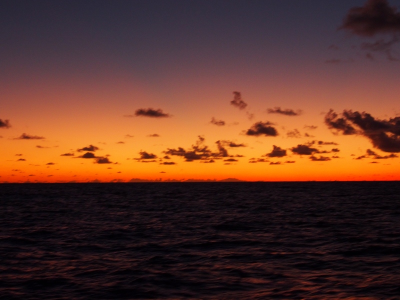
Our first glimpse of land is at sunrise on Day 19, when the island of Fatu Hiva appears in the distance ahead in the shape of three volcanic lumps rising out of the dark sea. The previous night we noticed low clouds on the horizon ahead which signalled land, but we were still too far out to glimpse the islands.
Land lookalike clouds on the horizon
There is no wind so we’re motoring the last day, carefully monitoring the diesel supply as we go, but it appears that we are not using much. In fact the gauge shows a steady increase in fuel throughout the day – we started on a quarter of a tank, and by 2 pm the gauge is showing a full tank! A dip stick confirms that we haven’t, in fact, made diesel, and we add a bust fuel gauge to the list of upcoming repairs.
The windless conditions have the sails flapping and banging and when we’re 25 miles from land the clew on the mainsail goes, the ring attaching it to the boom breaking. It’s not too big a deal; we’ll be able to improvise a fix until we reach sail supply facilities in Tahiti. We hear of worse misfortune on the high sea when the boat Kia Ora, a husband and wife team with whom we’ve been keeping in close contact during the crossing, email us relating how they’ve lost the use of their mainsail. The sail had got stuck when they were trying to lower it meaning that Ken had to climb the mast to cut the haliot. Fortunately the wind was light and the sea calm, and he escaped unscathed. But in any type of weather a mast climb can so easily go wrong, especially when people are exhausted and stressed to the max through weeks of sleep deprivation.
First sight of land at dawn
All the cruisers that we’ve met seem to keep night watch, mainly to keep an eye out for oncoming vessels (the chances of spotting other dangerous items such as shipping containers, floating logs and whales are exceedingly low and most cruisers accept the risk of bumping into these). Good night watching certainly proved invaluable on the nearshore legs we did in the Caribbean, where we found ourselves in close proximity to, and on collision course with, other vessels more than once. You would have thought that large commercial vessels such as tankers or fishing boats keep an eye out, but they tend in fact to rely more on instruments than on the human eye, and most radars won’t pick up a small yacht. I guess the big ships know they’ll come out ahead in any collision, whereas yachties keep a keen eye out precisely because they are likly to sink if they hit anything.
However, in vast areas like this leg of the Pacific where you are gone for weeks on end and there are no heavily used shipping lanes there is an argument for just putting on the autopilot, the radar and the AIS and just go to sleep (AIS: automatic identification system, mandatory for commercial vessels and often used by blue water cruisers, emitting signals which allows others to identify the vessel and ascertain its course and speed). With the appropriate alarms set, you can be woken up if anything shows on the radar or the AIS, or if the speed of the boat changes noticeably. There is no doubt that some cruisers do this, especially single-handlers of course, but I doubt that all double-handlers, like couples, can truthfully say that one person is awake and keeping a look out the entire 3000-odd miles from the Galapagos to the Marquesas.
The advantages to canning the night watches is that the major risk that sleep deprivation poses to judgement, decision-making ability and reaction time is reduced substantially. Imagine Ken going up that mast on a rolling boat on a good day – it is risky, but he is secure in his harness, holding on tight with his strong leg muscles, clinging on to the sharp tools with one hand, gripping the mast with the other as he sits there, 50 metres up, swaying wildly. Now imagine him doing it after more than two weeks of no more than two hours of sleep in a row, bone tired, shaky with fatigue, hoisted up by his wife who is equally exhausted, her heart beating wildly, hands wet with cold sweat, thoughts of what would happen if her grip slips swirling in her mind… She wrote that she passed out briefly when it was all over.
It certainly would be interesting to try to quantify the risks of sleep deprivation versus relying on instrument alarms during the night; it sure would transform ocean crossings if it turns out to be just as safe to sleep as to stay up. Whether we could really fall asleep knowing that no one is watching is another matter…
Happy to see land
Anyway, we no longer have to worry about such matters; the longest blue water crossing in the world is behind us. After the kids doing somersaults on the tramp the entire afternoon, we arrive at the Baie des Vierges on Fatu Hiva at 5:15 pm. It is a still evening, the bay is beautiful, and we’ve got corn beef pasties ready to go in the oven. Tonight, for the first time in 19 days, we will all get at get a full night’s sleep. What more can you ask for?