“Guess what they write!” exclaims David in disbelief. “They say ‘Well, you might have to rely on paper charts’!!”
“Really?” I lean in, looking over his shoulder at the computer screen. “That’s a bit odd for someone selling electronic charts. Kinda undermines their business model. How can they say that?”
“And look here,” he continues, his voice rising, his face turning red. “The guy writes that ‘our IT Department probably has more important things to do than helping you’!! Yes, I guess everything would be more important than helping a customer!!!”
I scroll through the strand of online messages – a long conversation filling up several screen-lengths.
“So what will we do?” I ask. “I mean, we can’t go without charts?”
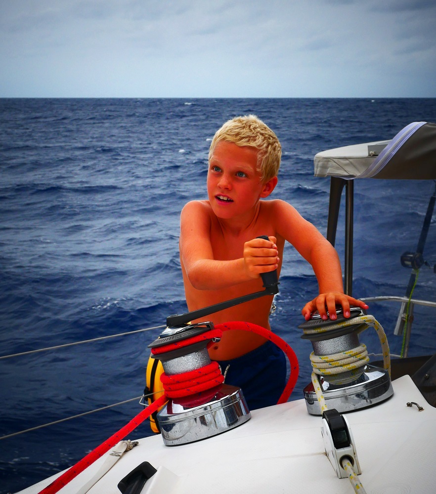
David has been trying to download new charts for our GARMIN chart plotter for several days. We’re leaving Vanuatu and need charts for our upcoming destinations. He has purchased the charts but is having problems downloading them, because GARMIN won’t recognise our account with them. Even though we’ve bought charts with them before. They maintain that our chart plotter is registered to someone else, and insist on checking with this individual before allowing us to download the charts.
To try and speed up the process, David has been having online conversations with their Helpdesk via a chat function. He’s been trying to impress upon them that we are about to head offshore and that it would be great to have some charts for the journey. Only it seems they are not very interested in helping out.
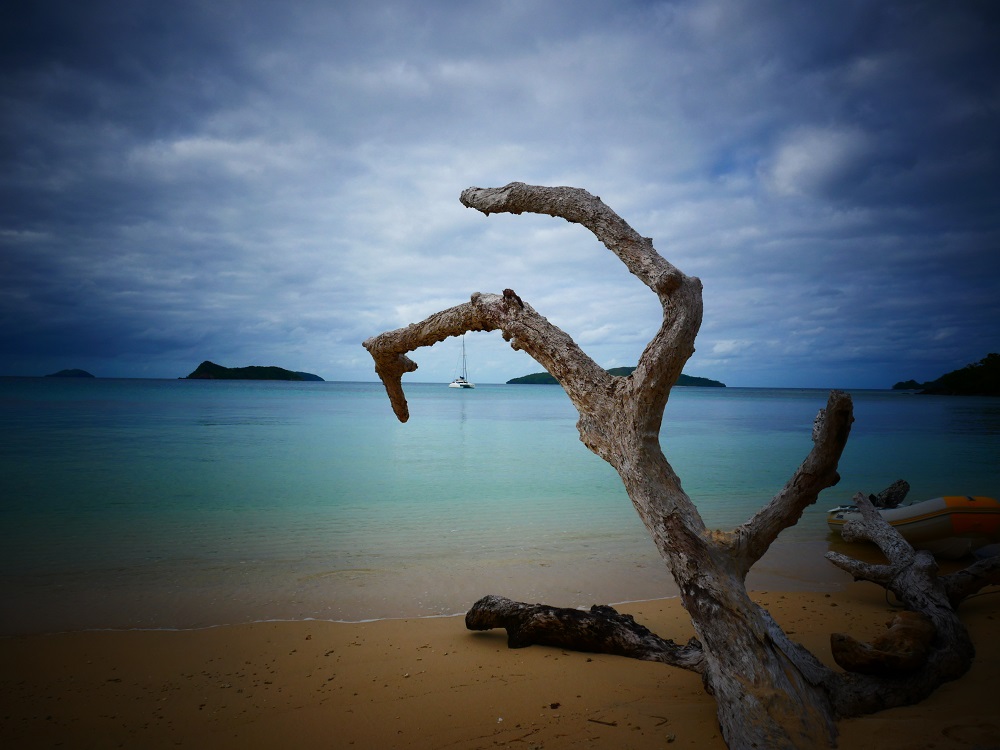
Vanuatu has 83 islands and on this visit, we managed to visit seven, including some smaller islands that we kited from. It is not enough, but the cyclone season is drawing nigh, and head north we must.
Officially, the South Pacific cyclone season starts in November, which means that prudent sailors want to be out of here by the end of October. Cyclones are related to sea surface water temperature; when surface temperatures are higher than 26°C, cyclones can form. (Basically, the sea surface temperature is what powers the storm.) As you move closer to the equator the risk decreases because the Coriolis force (an effect caused by the spinning of the Earth) is too weak to allow a weather system to start spinning up. Cyclones are defined according to wind speed, and wind speeds are unlikely to get to cyclone level at the equator where there is minimal spin.
The weather has been behaving weirdly this year. Last week, Cyclone Liua hit the Solomon Islands just north of here and just south of 10°S. It is almost unheard of to have a cyclone in September, but the sea surface temperatures were abnormally high, and so it developed. The Ni-Vanuatu are justifiably on the alert, fearing a long and bad cyclone season ahead. Civil warnings are distributed effectively via the mobile network here, so anyone with a phone receives free notices of storms, earthquakes, tsunamis and suchlike.
Brown river water gives way to blue ocean water as we leave Luganville and its rivers behind. With the recent heavy rainfall, the bays of Luganville are mud brown.
Our insurance stipulates that we must be out of the cyclone belt by 1 November. The equatorial band between 10 degrees north and 10 degrees south is considered safe, and so we need to make our way there.
Our plan is to head west and somewhat north. From Vanuatu, we will embark on a long trip westward to Indonesia via the Torres Strait. The distance from Vanuatu to the Kai Islands (south of the western end of Papua) where we will check in to Indonesia is about 1800 nautical miles. When sailing, we travel roughly as fast as a fit runner can run, with average speeds of about 11-15 km per hour. In a typical 24-hour day passage day we cover 150-200 nautical miles (280-370 km), so sailing 1800 nautical miles straight would take us 9-12 days.
Passages are tiring…
However, long passages are hard work. The necessary night watches interrupt sleep and weather forecasts get less reliable the longer the forecast horizon, which means that what looks like a good window to sail in could turn bad as the weather keeps changing ahead. We like both sleep and remote locations, so we’ve decided to spend up to six weeks getting to Indonesia, stopping at select spots on the way to break up the journey, get some sleep, update our weather routing, and see some cool spots.
Our first stop will be at Indispensable Reefs, a landless reef system consisting of three atolls enclosing lagoons we can anchor in about 450 nautical miles north west of Vanuatu. It will take us about three days to get there.
From Indispensable Reefs we will continue to Port Moresby on the Papuan mainland via the Louisiade Archipelago of outer Papua New Guinea. The trip from Indispensable Reefs to the Louisiades is about 450 nautical miles (three days), and from the Louisiades to Port Moresby about 350 nautical miles (two to three days).
In Port Moresby, we will await a suitable weather window to manoeuver through the Torres Strait. The passage through will be tricky. The Strait is shallow (7-15 m) and narrow and has a busy shipping channel running through it. It is ravaged by strong tidal currents and bordered by treacherous coral reefs to the north and south. Given the abundance of potential hazards, we will need a good weather forecast for this bit of the trip and stopping in a marina in Port Moresby allows us to be as well prepared and rested as possible. We also need to stop in Port Moresby to get our Indonesian visas at the embassy there.
Hi Mummy – are we there yet?
It is a long trip and we’re anticipating it with excitement. Any passage is demanding, involving as they do days of seasickness, interrupted sleep, constant motion and no opportunity to get off the boat. But ahead lies the Indo-Pacific region, oceans that Bob has never sailed, areas of exciting culture and amazing wildlife. The trip getting there will bring us to some of the remotest parts of the world, places visited by just a handful of people. The small hops we’ve planned will break up the journey and give us time to rest and enjoy places so far off the beaten track that they can only be reached by boat. Traversing the Torres Strait is going to be demanding, requiring careful planning and fortuitous weather, but with the scheduled stop at Port Moresby, we will be able to approach it with a solid weather forecast and rested crew.
Cruising the South Pacific has been amazing, and we feel fortunate we have been able to see so much. Now it is time for new shores, and we’re looking forward to all that they will bring.
One thing for certain, without charts the trip will be full of surprises…
“So what do you want to do?” I ask. “We’ve checked out now, have a perfect weather window – we almost have to go. Can we get by on the Navionic charts?”
David looks at the screen, frowning. “Well, that and paper charts, I guess,” he says, sighing deeply.
The Navionic charts for the region are fine, the only inconvenience is that we have to display them on a tablet instead of the main chart plotter. We’ll head off tomorrow morning and leave the GARMIN guy to try and persuade his IT colleagues to reset our account. By the time we reach some internet in Port Moresby we hope they will have sorted it out. Although GARMIN does have a pretty lousy track record – their online approval rating is one star out of five, and most reviews go something like ‘I will NEVER purchase a GARMIN product again. Their customer service is non-existent!’ etc. And if they don’t sort it out, we’ll just have to try again with them once we get internet.
We are unlikely to have much internet until we reach Port Moresby about four weeks from now. But we will keep in touch with family and friends via our satellite email.
“Mummy, what are we going to do today?” Lukas is looking at me expectantly. Behind him, the cockpit clears show a blur of grey behind a curtain of droplets.
“I don’t know,” I answer brightly. “Maybe we could have a shower in the rain?”
His eyes light up.
“Matias!” he yells. “Come, let’s go and have a shower on the trampoline! Get your togs!”
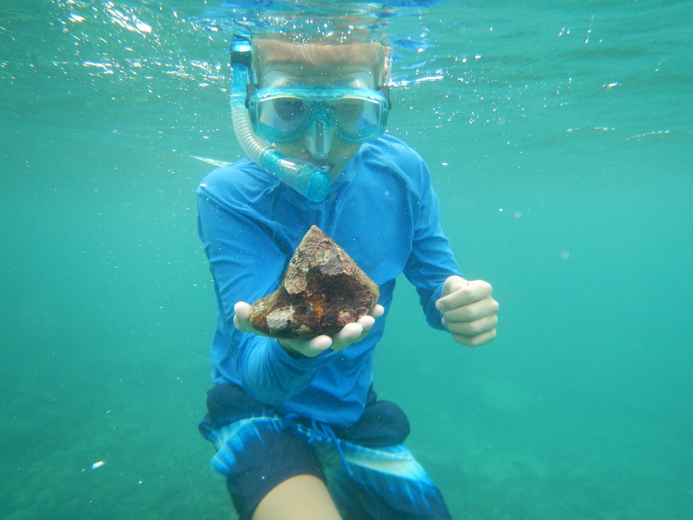
Matias finding large trochus shell.
It has been raining on and off for ten days week now, heavy dark skies and oppressive heat interrupted by all types of rain imaginable: light, dusty showers moistening the skin and frizzing the hair; fierce rain waterfalls creating walls of rain beyond the cockpit; stormy rains with droplets like bullets tearing into you should you venture outside. The ocean is freckled with raindrops, the rivers bursting their banks, and the nearshore waters brown with mud.
Wet weather makes for a soggy boat, and everything is damp on Bob the Cat. I wipe the walls daily using vinegar, hoping that its antifungal properties will ward off black mould. Our towels are moist, our clothes feel damp to the touch, and our canvas cover is saturated to the point where water is dripping through into the cockpit.
It’s not ideal weather for sightseeing, but we’ve done our best.
We’re in Espiritu Santo, the biggest island in Vanuatu. The island was extensively used by US forces in the second World War, and the wartime history is present all over. The US established bases here, active from 1942 to 1945 when Japan was defeated. As the US troops withdrew, they left behind a lasting legacy and vast amounts of equipment.
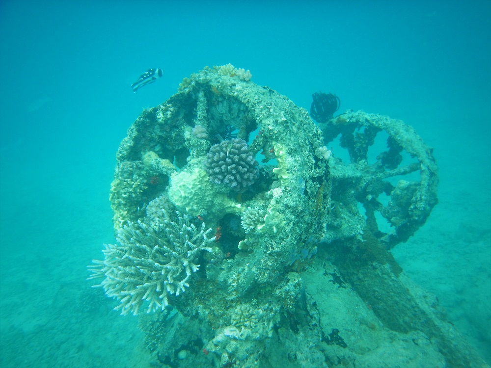
Sunken treasures on Million Dollar Point
While here we snorkel the famous Million Dollar Point where the Americans dumped millions of dollars’ worth of military equipment just to ensure that the British and French didn’t get their hands on it. The legend goes that as they withdrew, the US offered the equipment to the British and French (the nations ruling Vanuatu at that point) at ridiculously low prices. The two nations, however, thought that the US would have to leave the equipment anyway, and declined the offer to buy thinking that they would get the equipment for free when the US forces abandoned the island. This irked the US, who decided to spite the British and French by dumping the equipment in the sea rather than let them have it. And thus bulldozers, military ships, aeroplane engines, jeeps, tanks and crates of coca cola were dumped in the shallow waters just offshore Luganville, the main town in Espiritu Santo.
It is a peculiar site. A nice, white beach is strewn with metal debris and as we swim out we survey the underwater military rubbish dump. We find shipwrecks, vehicles, wheels scattered all over, tanks, and lots of unrecognisable structures.
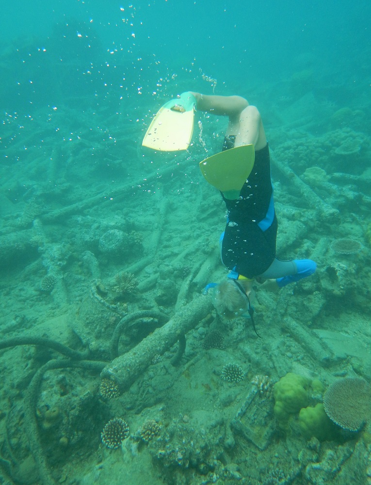
Matias surveying the wreckage
Also a wartime casualty is the wreck of the SS President Coolidge – one of the largest shipwrecks in the world. A luxury liner appropriated by the army, the huge ship (187 m long) was struck by a mine and sank just off Luganville. The wreck is still rather intact and full of equipment, including supplies, guns, tanks and other vehicles, making for an interesting dive.
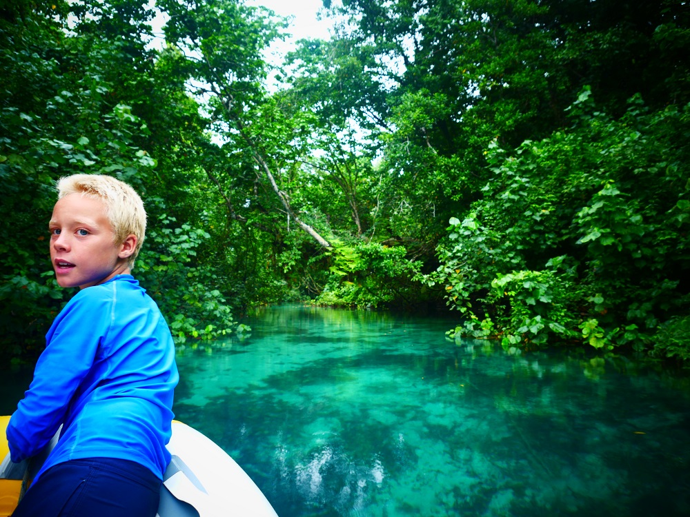
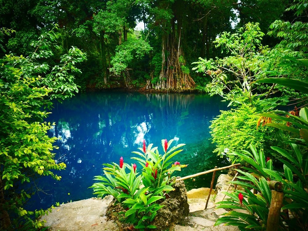
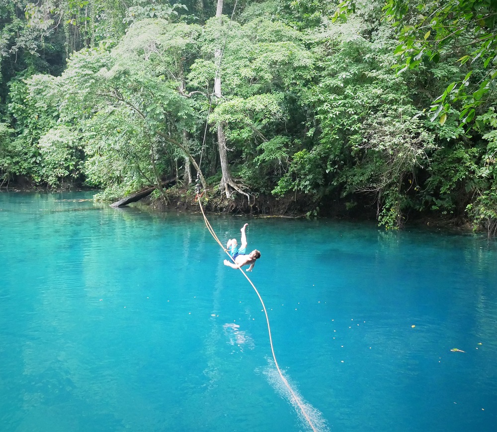
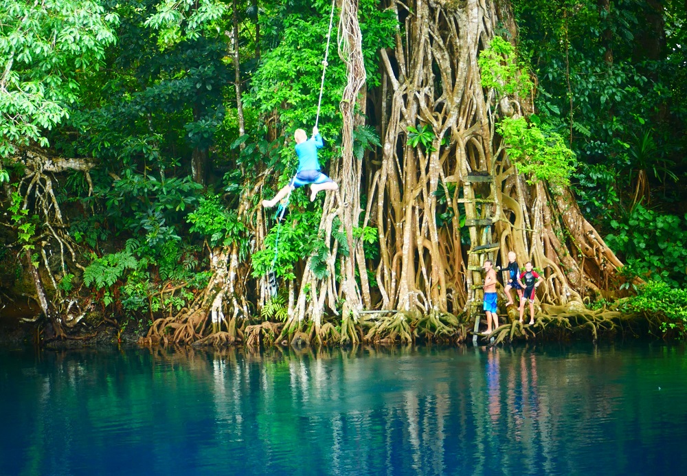
Blue hole surrounded by jungle.Hanging on by a thin thread.
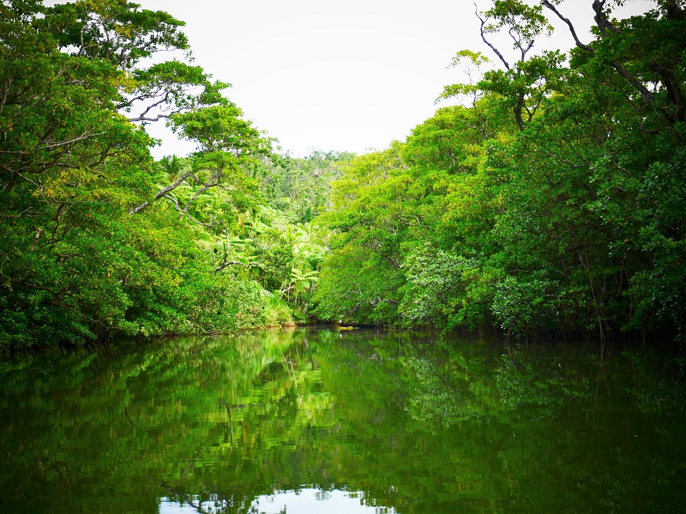
It is not all war, though. In between rain showers, we travel up long, still rivers where the green jungle is perfectly mirrored in the shallow water to visit gorgeous freshwater blue holes. Ropes hang from overhead branches and the kids spend hours flying through the air and cannon-balling into the deep blue waters.
David – attempted back flip turns into back flop.Lukie taking the plunge.Matias on a rope swing.
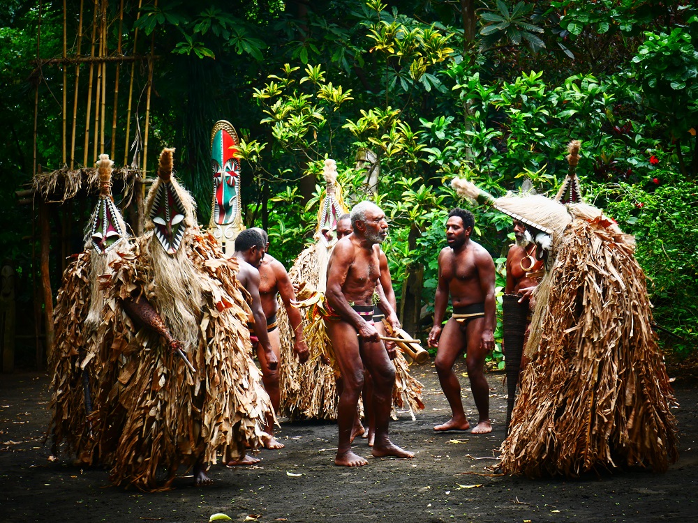
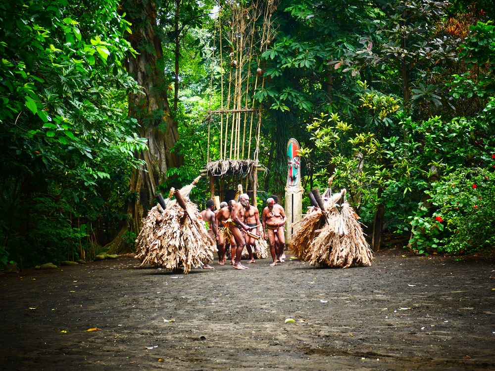
“Haiahoieh, haiaho!” chant the men, stomping their feet on the ground, small clouds of black dust rising. “Haiahoieh, haiaho!”
They sway and shuffle in front of the giant, brightly-painted carved wooden statues backed by green jungle, expanding and contracting in a tightly-woven circle, their backs to the assembled crowd. One man beats the rhythm of the song on a traditional drum, and the beat quickens with each footstep, sweat beginning to appear on their near-naked bodies. “Haiahoieh, haiaho!”
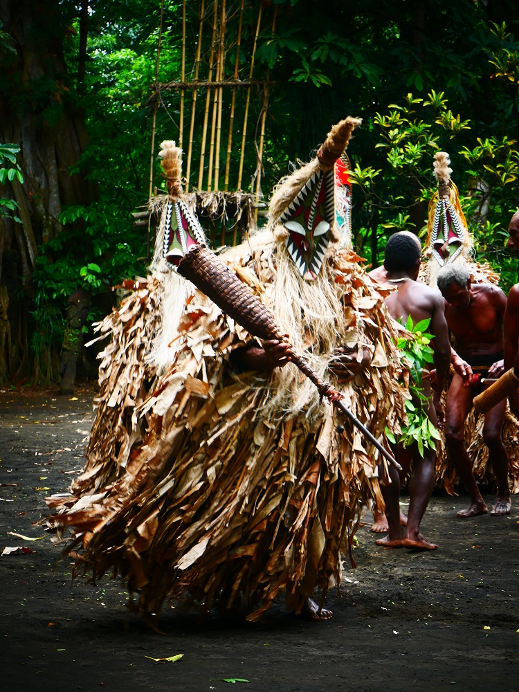
Suddenly, from the right-hand side, a fearsome creature whirls into the clearing, brushing past the audience and spinning its way towards the dancers. It is a man clad in an extraordinary costume – a conical carved hardwood mask featuring heavy white eyelids and intricate designs in green, red and white shapes, creating a fearsome grimacing whole. The mask chin culminates in a long whitish beard and the top of the head is adorned with a series of light tufts which extend down the back of the head to form long, white hair. A feathery cloak of dried banana leaves covers the dancer’s entire body. Shrouded in the mask and cloak, brandishing an elongated hollow club, the wearer looks like a rare demon bird, twirling and whirling, stomping and singing, the feathery cloak swishing with the movements of the dance, fragile dried banana leaves extending like an elaborate golden tutu. A moment later another masked dancer joins from the right, and after that another and another, until the dancing group is complete: six men in the middle wearing the traditional costume of a small woven penis sheath attached to a belt flanked by five menacing mask-wearers.
Fearsome mask-wearer.
We are witnessing the famous Rom dance on the black volcanic island of Ambrym.
The Rom dance is a coming-of-age and advancing-in-status ritual dance done by men in villages in northern Ambrym. When a man wants to move up in the village pecking order, he must buy access to a sacred mask design, for which he pays in pigs, roosters and cash. The masks represent spiritual aspects of the power of yam, the most important food crop on the island. Once he has secured a mask design he is initiated and learns the ancient art of mask making in a series of top-secret rituals which culminate in a performance for the village where the man and select invitees dance wearing the extraordinary and powerful masks.
The dance lasts for about 40 minutes, the men in the middle shuffling and stomping, the mask-wearing demons whirling and rushing, grandstanding one moment, huddling the next. The beat of the drum carries the rhythm, supporting the feverish chanting until suddenly the pace quickens until a crescendo is reached and the dancers utter a last ‘Ho!’ and stop, sweat pouring off them.
We are in awe of the performance and feel lucky to have witnessed a ritual which, although this one was performed for tourists, is still very much alive on the island. The Rom dance is held once or twice each year and the dancers are proud to display their traditions to the world.
The island of Ambrym is home to two volcanoes and a bunch of magic. According to Ni-Vanuatu, magic is strongest on islands featuring active volcanoes, and as Ambrym is home to two active volcanoes the island is Vanuatu’s sorcery capital. Sorcerers (man blong majik or man blong posen) abound on the island, casting spells and generally disrupting normal village life. The twin volcanoes are sacred and pleasing the mountain gods is essential for securing good and plentiful yam harvests.
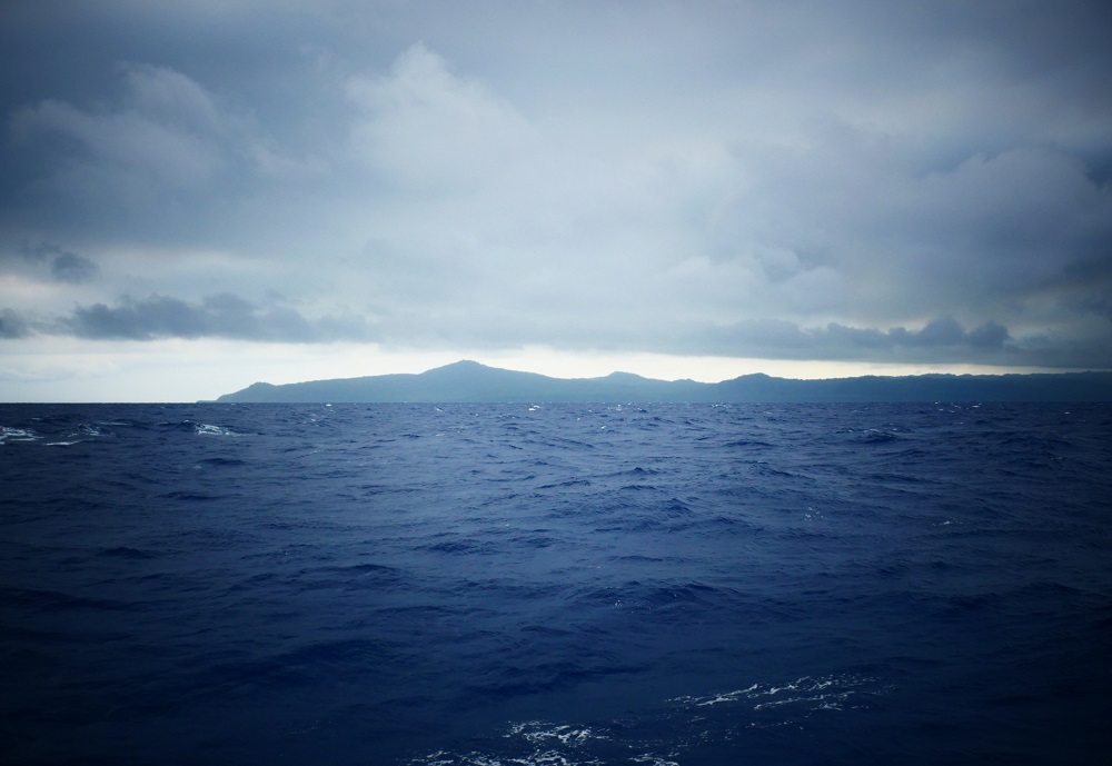
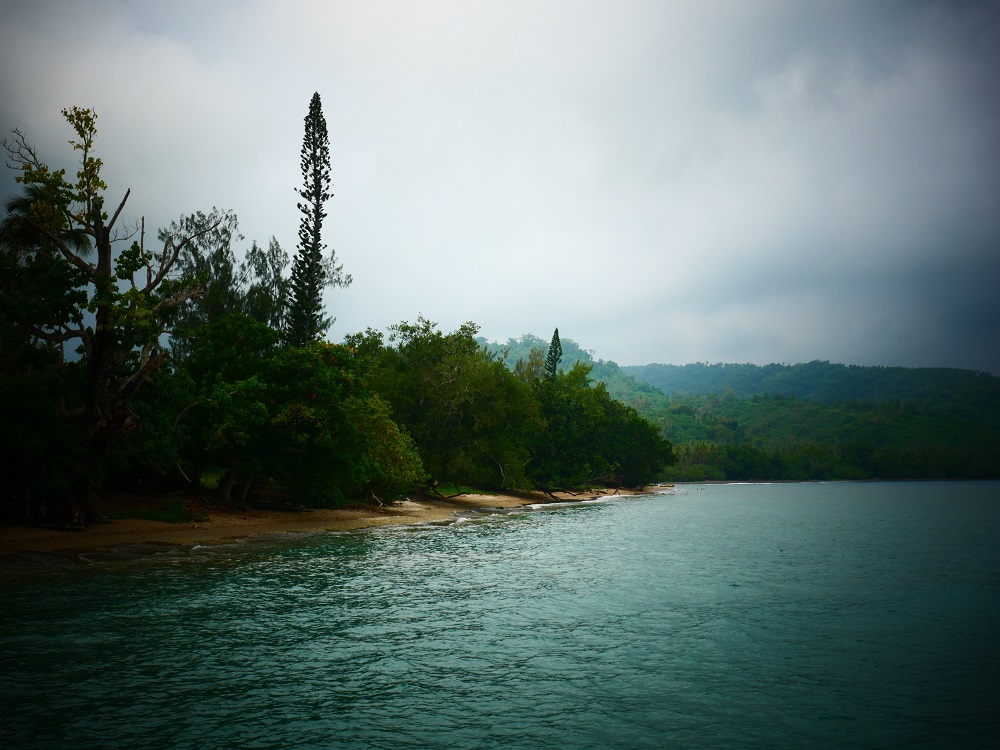
When we approached Ambrym from the south the island was shrouded in clouds – heavy grey fog hung darkly over the volcanic peaks, wispy strands of mist encroaching on the dark green hillsides like odourless white smoke from a thousand jungle fires. We anchored in a bay on the north-western coastline in front of Ranon village which is scenically set back behind the long, soft, black sand beach.
Ambrym – island blong blak majik.
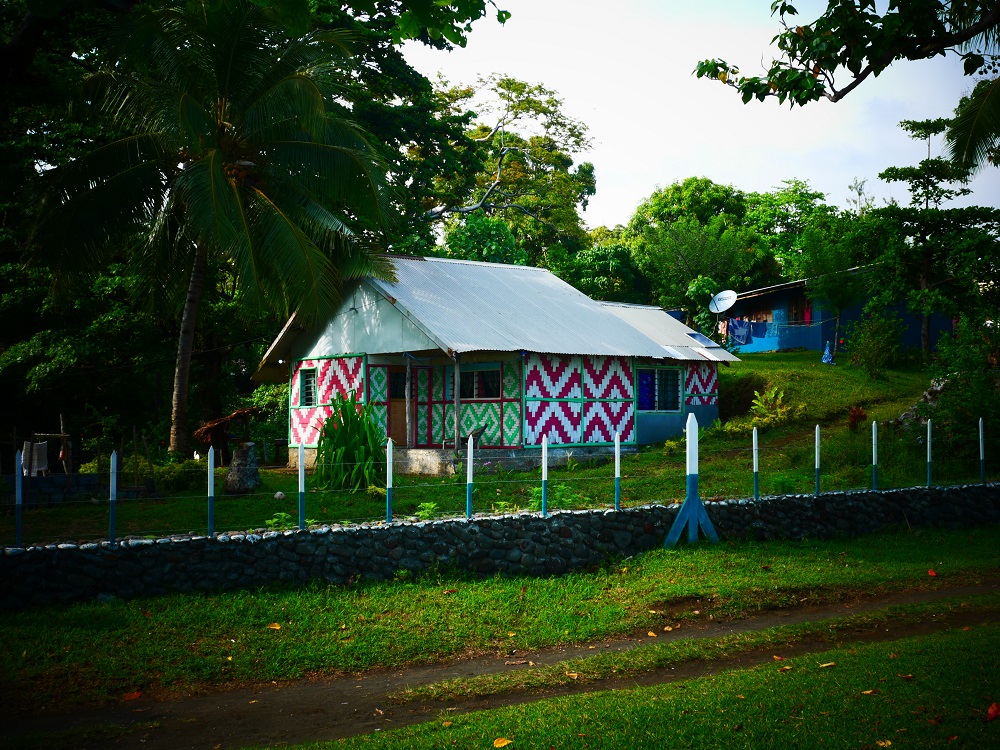
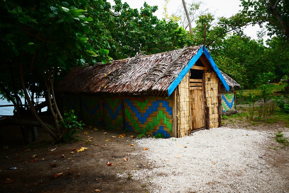
The villages here are small and tidy. The small, rectangular houses have walls woven from bamboo, the weaving forming varying geometric patterns sometimes accentuated by dye. Pigs and chickens root around between the small houses. Adults sit talking on benches near houses and gangs of scantily clad children run about squealing with laughter. Heavy mango trees have just started to drop their fruity burden, providing ample food for foragers, and all children we see carry armfuls of the small green fruits, black eyes peering out at us over mouths full of yellow fruit, chins dripping with sticky juice.
Colourful village house.Mango season.
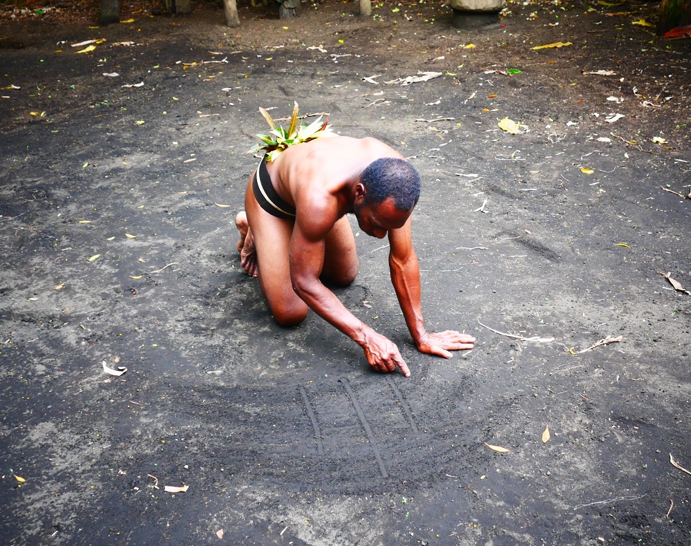
The art of sand drawing is strong on Ambrym. Done on a clean-wiped piece of dirt, the art illustrates ancient oral traditions. The drawings are large, symmetrical, intricately patterned shapes drawn without the artist lifting the finger from the sand, representing birds, turtles or parts of the human body.
Sand drawing in Fanla village.Finalised sand drawing, representing the human heart and lungs.
The village of Fanla still remembers when Captain Cook came to the island. In 1774, the Resolution was anchored where we are now. The first man to spot the large ship stood terrified on the beach, watching Cook come ashore with a small party in a rowing boat. As is the custom in Vanuatu, the local Big Man (chief) offered the visitors some yam, the traditional staple. As he proffered the yam, he said ‘Ham rim’, which means ‘here are some yam’ in the local Ranon language. Cook misunderstood, thinking that the man was telling him the name of the Island, and wrote down the name as Ambrym. (Cook seems to have made a habit of misunderstanding the natives of Vanuatu when he charted the area. He named Tanna Island in the south after meeting some locals and pointing to the ground. When they said ‘tanna’, the local name for ‘dirt’ he promptly wrote that down and went on his merry way to do more charting. Presumably, those sorts of misunderstandings were common job hazards for early cartographers. I guess the upside for Vanuatu of having talkative natives is that Cook named fewer places ‘Disappointment Bay’, ‘Cape Hopeless’, ‘Starvation Point’ and suchlike, names that abound in New Zealand and Australia. Although there are a few ‘Cannibal Coves’ found here…)
Cook gave the Big Man some iron nails and a smoking pipe, historical treasures that the villagers still hold in their possession. The gravesite of the man who first met Cook is still standing in a little clearing just outside Fanla Village.
Cultural tensions between the modern, western world and the old, traditional Vanuatu ways started that day on Ambrym, with Captain Cook gifting iron to islanders who were living a stone-age existence. Today, these tensions are as strong as ever, with traditional culture like the Rom dance, majik, and the sacred rituals involved with the yam planting and harvest threatened by a world of cell phones and the intrusion of the all-pervasive western culture. Nowadays, most young men leave the island after Year 10 of school, heading to Malekula, Port Vila or Luganville for further education. Many go on to work overseas; all people we speak to mention relatives that work seasonally as fruit pickers in New Zealand or Australia. In Fanla, the chief’s son worked for a season as a fruit picker in Australia; now he is building a concrete house right in the middle of the village, the incomplete foundations surrounded by traditional small, woven bamboo houses. It must be strange for a young man to move from a culture of magic masks and ritual dances to fruit picking in Australia and back again.
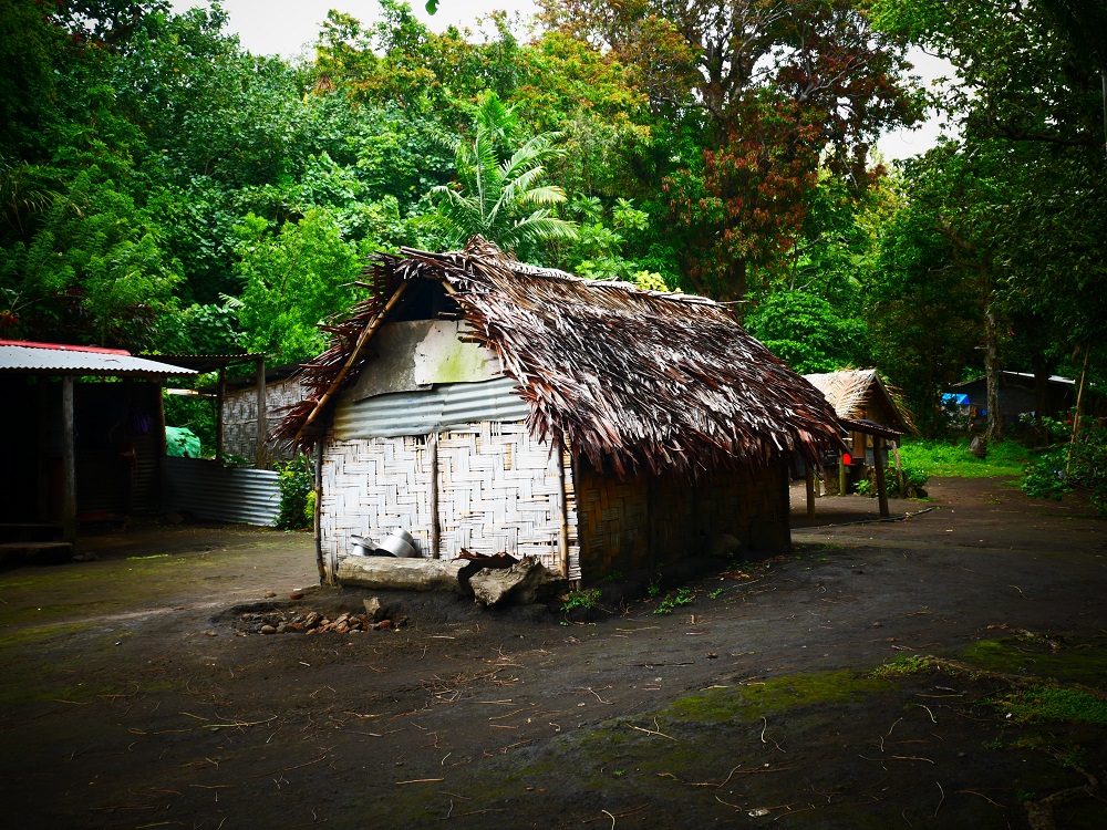
Traditional village hut.
“It must be difficult to keep the traditions when the young people leave?” I comment to Freddy, a local man who is showing us around.
“Yes,” he admits. “We try to teach the young people our culture, tell them that they can make an income from our traditions – like wood carving, and the Rom dance. We hope we can keep our culture alive, it is important for us.”
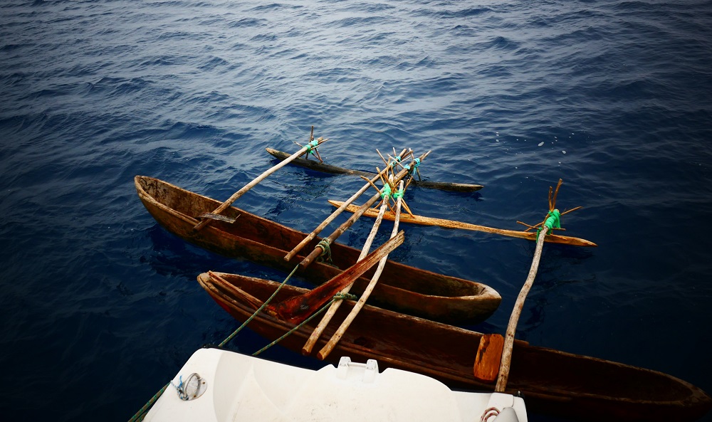
Outriggers visit Bob the Cat.
One afternoon several young men paddle up in small outriggers to say hi. We invite them on board and chat for a while. They are 15-16 years old, and with their neatly groomed dreadlocks, their second-hand surf t-shirts, fashionable earrings and winter beanies they look like they could have come straight from the streets of Auckland.
“Will you live here when you are older?” I ask Christophe, one of the first guys to come on board.
“Yes, I will live here,” he says. “It is a good place. I will leave to do more school in Malekula. But I will come back here.”
From all over the island, they are boarders at the secondary school in Ranon. We discuss the Rom dance, and they explain that they have similar rituals in their villages – masks that are used in initiation rites, which they will earn the right to wear when they become grown men, at the age of 18-20. They say the dances are tricky and that there is much to learn about the masks and the kastom behind them. But they are looking forward to the day when they join the ranks of men in their village.
David helping to transport the visiting teenagers and their outriggers back to shore.
Rope is a precious commodity that is hard to come by, and several men approach us in the villages, asking if we want to trade rope for carvings. The rope is for tying up their cows, a job for which the natural fibres are not well suited. We find several decent second-hand ropes to swap for the beautiful carvings for which the island is famous.
We were hoping to climb the volcanoes, but as befits an island blong blak majik the dense, dark cloud cover that envelops the twin peaks never lifts during our time here, and our impression of the volcanoes remain a faint orange glow spreading above the hillside at night.
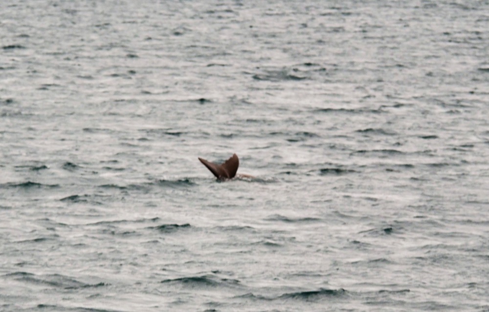
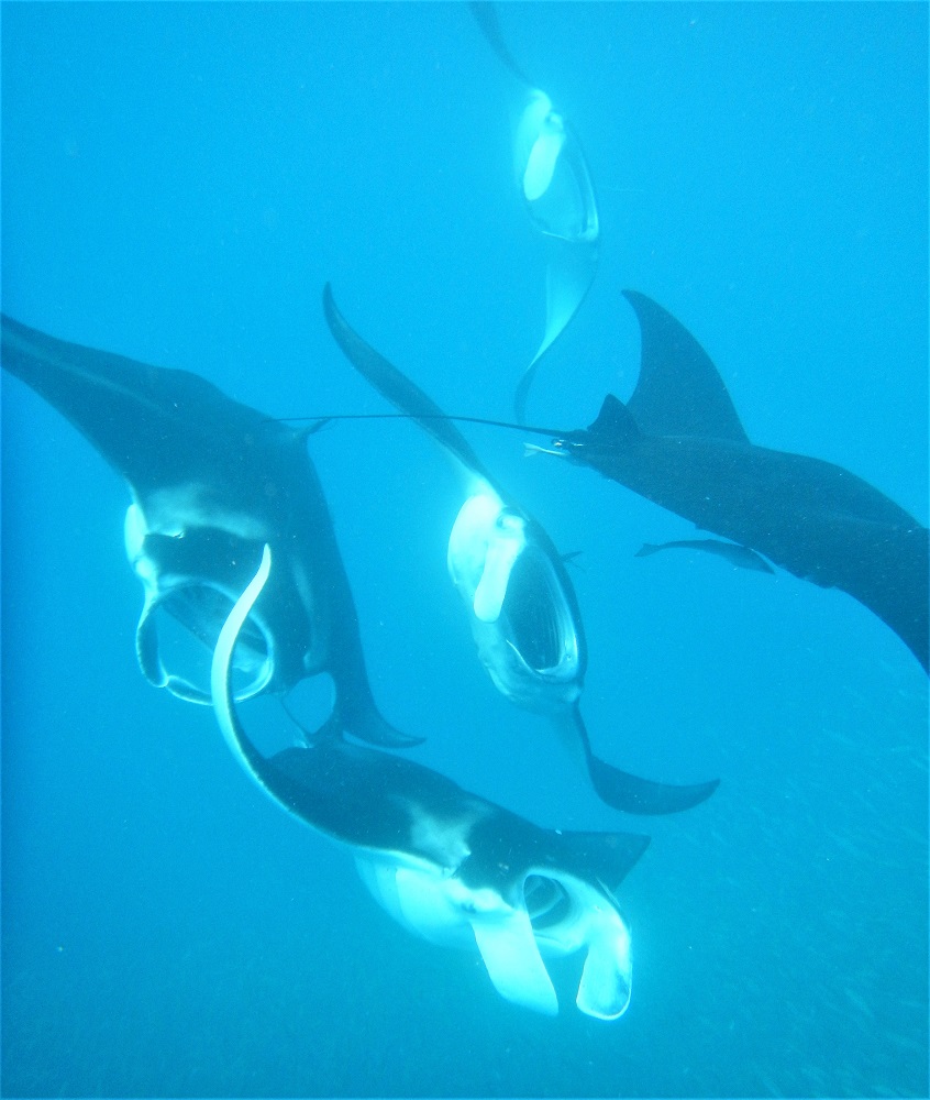
I’ve been wanting to see a dugong forever. I remember reading about them as a child in a Jaques Cousteau book we had lying around at home. Fascinated with their immense blubber, their hoover-like mouths, their docile grazing habits, I vowed when I was 10 years old that one day I would see one.
Now that we’re in Vanuatu I feel sure that the time has finally come. We’ve been in dugong territory before, in New Caledonia, but despite keeping vigorous lookout I never spotted one. The mistake we made was to assume they were like dolphins – that when they were about we would spot them, and that once we spotted them they would be interactive, frolicking around the boat, swimming up to us as we snorkelled.
Looking a bit more into dugong behaviour it seems I was naive. They are known to be incredibly shy of humans and have no desire whatsoever to play. Although they breathe fairly often (every 4-8 minutes) they don’t spend long on the surface at all, often just sticking their nostrils out of the water for a split second. Nor do they make any noise – no squeaking or clicking like dolphins or heavy breathing accompanied by clearly visible water spouts like whales. They spend almost all their time vacuuming the ocean floor, ingesting huge quantities of seagrass to keep up their well-padded appearance.
Dugongs are found in several areas of Vanuatu, and the mission when we leave Port Vila is to find one.
Our first stop is the northern end of Efate Island, where we spend a couple of days kitesurfing in high winds under moody skies. A private island offers a brilliant sandspit on which to launch; unfortunately, the absentee owner is not keen on us using it, so we launch in the water but the kids are still able to enjoy the flat water shallows.
There are meant to be dugongs in the area, but the windy conditions mean that it is almost impossible to see them – the water surface is broken by waves and they could be having a big meet-up right next to the boat without us noticing.
Matias kiting in the shallows no doubt passing over several dugongs.
After Efate, we head to Lamen Bay in Epi Island where dugongs are sometimes seen. The elusive beasts are absent, but lots of very chilled green and hawksbill turtles inhabit the bay, providing for some great snorkelling.
Green turtle flanked by remora.Local house in Lamen Bay, Epi Island.
From Epi Island, we head to Malekula Island. Malekula is famously the last place in Vanuatu where a human being was eaten, in 1969. It is also famous for the two inland tribes, the Big Nambas and the Little Nambas, named for the size of the men’s penis gourds. In addition to this interesting phallically-focused cultural division, they have dugongs.
We anchor in Gaspard Bay at the southern end of Malekula. The bay is a grey expanse of shallow water lined by lush islands bursting with green. The bottom is covered with seagrass, the preferred food of dugongs, and there is a resident population which is the target for many tours.
We kayak the perimeter of the bay, keeping an eye out for dugongs and surveying the seemingly impenetrable hillside jungle beyond the mangrove fringe. As we get closer to the shore, the noise rises to a deafening buzz of cicadas and birdsong.
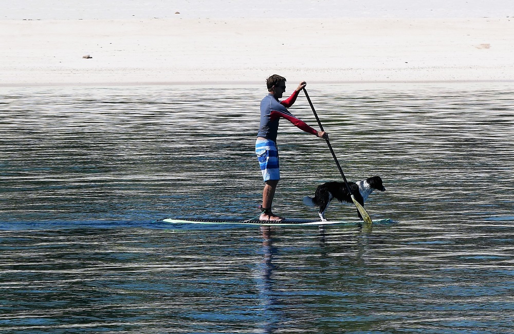
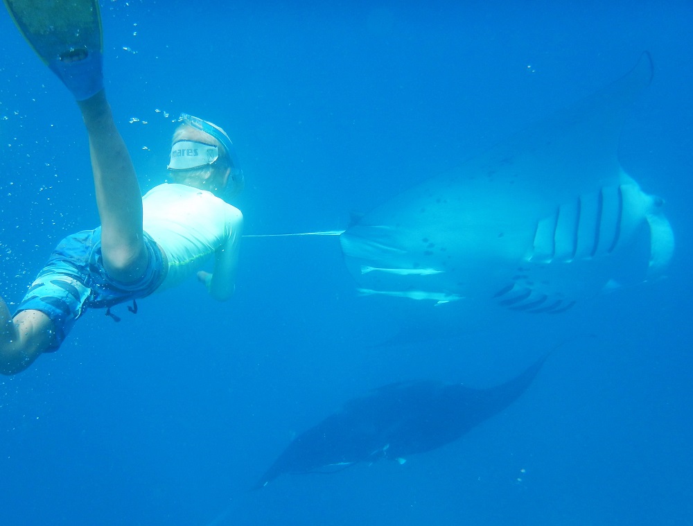
The dugongs are about but hard to sneak up on and to begin with we only snatch brief glimpses: a square, grey snout sticking vertically up the water, quickly vanishing when I approach in the kayak, the gentle arc of a finless back curving through the water just ahead of David on the paddleboard.
David and the kids dugong hunting in Gaspard Bay.The tail end of a dugong.
On our second morning, the show is finally on when a dugong mother and calf surface right next to the boat, treating us to a nice view of tailfins and blubbery brown shapes logging just under the surface and generally frolicking around. David jumps in the water and manages to snorkel with them briefly, watching the pair slowly dive down and vanish in the murky depths.
I would have liked crystal-clear waters and a throng of dugongs so thick I couldn’t swim through it but realise that Gaspard Bay is probably as good as it gets with dugongs here. So I pronounce myself satisfied and we are finally able to move on. Next stop: the black magic volcanic island of Ambrym.
More approachable wildlife on Efate Island.View from Lamen Bay.
Our passage to Vanuatu was easy, taking four days and three nights, with calm seas sighing like ghostly whales pursuing our slow progress across the ocean. Vanuatu’s capital Port Vila, on the island of Efate, is due west of Fiji, so during the four days of passage we moved further and further away from the sun, the distance covered marked by ever later sunrises and sunsets. In this age of air travel, it is gratifying to be moving so slow (about 160 nautical miles, or ~290 km a day) that the incremental distances covered are felt as minutes of delayed sunsets per day, a visceral illustration of how the Earth is just a rotating ocean-covered ball spinning around the sun.
Angry booby.
On our second ocean day a booby hitched a ride for a night, landing on our rear solar panel after circling the boat for half an hour and remaining fast asleep with its head tucked under a wing on the bouncing boat as we transported it 100 NM west overnight. Come early morning it left after staring at us with stiff, tired eyes, indignantly lifting its head and ruffling its feathers whenever we got too close.
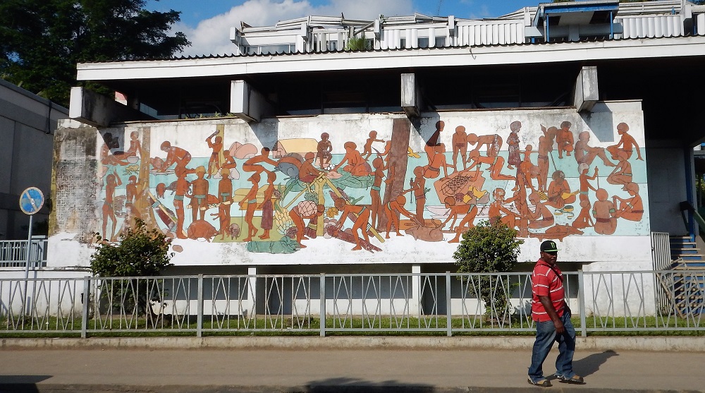
Wall mural in Port Vila.
Port Vila is small and full of Australian and New Zealand cruise ship passengers and the associated duty-free shops, selling French fashion, surfwear, perfume, handbags and alcohol. There are numerous restaurants and cafes, a small park and a bit of concrete for the kids to skate on. Beautiful tropical flowers border the parks, and palm trees are scattered across the lawned waterfront.
Fun at the park.
Bislama, the official language of Vanuatu is a pidgin language based on English with a few French words thrown in. Written Bislama is best understood by reading it out loud, exaggerating every syllable until the underlying English or French word becomes obvious. We buy SIM cards and I get a message advertising ‘tripol data tedei’ (triple data today), a ‘limited taem offa’.
David and I childishly find the language hilarious, particularly the liberal use of the word ‘blong’ (literally belong).
“Here, you have to see this,” I say, pulling him over to the ATM in town. “I can read Bislama. ‘Plis pusum kad blong yu i go insaed’ – Please put card belong to you it goes inside!”
“And here, the next screen – ‘Sipod kad blong yu i lus o wan man i stilim, plis kontaktem branj blong bank blong yu’ – if card belong to you is lost or a man steal him, please contact the branch that belongs to the bank that belongs to you!”
“And look at the library,” he responds, grinning broadly whilst gesturing towards a tall, dark building nearby. “Pablik Laebri Blong Port Vila”.
Hello is ‘alo’, thank you is ‘tankyu tumas’, sorry is ‘sore’, yes is ‘olraet’. Helicopter is ‘mixmaster blong Jesus Christ’.
Port Vila’s fresh market.
The provisioning here is great – if nothing else, the French left one positive legacy and the Bonne Marché is stocked with patés, cheeses, cured meats, feta cubes preserved in herbed oil, Nutella and other typical French delights. The fruit and vegetable market is sensational, a covered plaza stuffed full of fresh produce, sold by island women clad in colourful dresses sitting behind low counters. There is broccoli, red cabbage, pamplemousse grapefruits. Fragrant fresh coriander and lettuce heads strung on the bones of palm leaves. Shiny capsicums, rough custard apples, and buckets of glistening bush raspberries. Woven baskets of sweet potatoes and tripods of enormous yam, their tops tied together with palm leaves.
Fresh flowers at the market.
The entire country of Vanuatu is plastic bag free, and customers are expected to bring their own bags or baskets. At the supermarket, reusable plastic nets are provided for customers to weigh their fruit and vegetables; these must be surrendered at the check-out where you are expected to pour the produce into your own bag.
Perhaps partly as a result, Port Vila is remarkably clean. I remember the plastic mess of Tonga where we saw hordes of local kids throw plastic bags from their popsicles into the ocean. Here, there are bins everywhere, and no litter in sight.
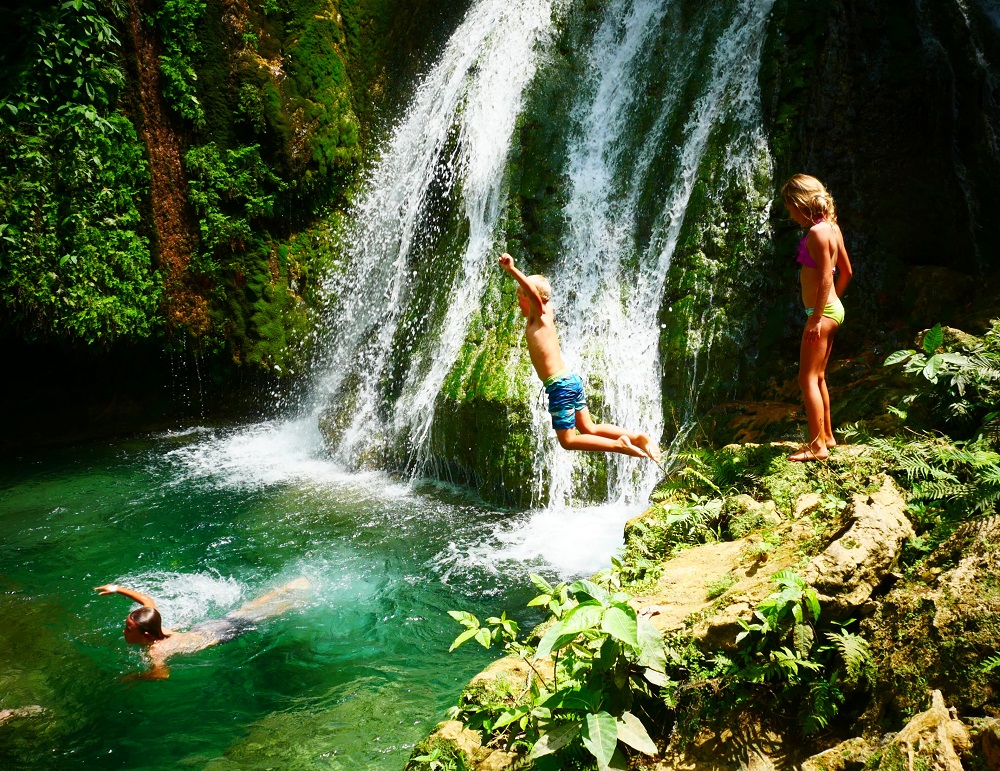
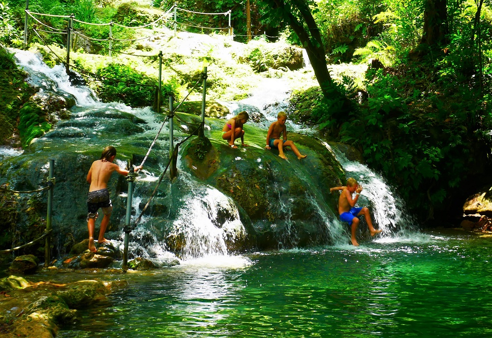
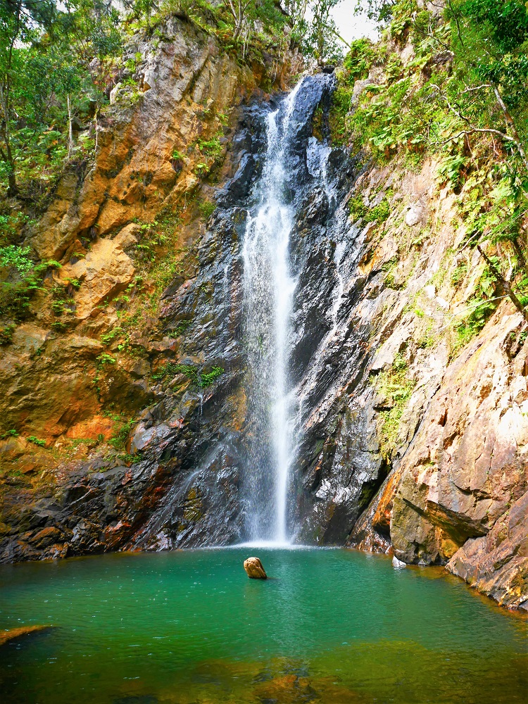
We visit the Mele Cascades not far from Port Vila, a beautiful walk up a hill through cascading clear water. We all swim in the cool water and enjoy the beautiful scenery.
Tomorrow we’ll leave to head up north, hoping to spot dugons on the way.
“PACIFIC PAWA!” shouts the man with the megaphone.
“PACIFIC PAWA!” responds the crowd, fists pumping, bodies bouncing, sweat pouring in the hot midday sun.
“WE’RE NOT DROWNING! WE ARE FIGHTING!” yells the man.
“WE’RE NOT DROWNING! WE ARE FIGHTING!” echoes the audience, erupting in cheers.
The small hair at the back of my neck rise as I feel the surge of emotions of the protesters and supporters alike. The guy with the megaphone is wearing a tie-dyed sarong and a black t-shirt with a white logo on the front. Around his neck is a long necklace of oversized wooden pearls, and on his head, a spiky crown woven from palm leaves holds in his short, tight dreadlocks. Behind him, men, women, and children jump up and down in tune to the chanting, waving homemade paper banners and flags. Many hold up dainty palm leaf windmills which spin in the light breeze, small hazy clouds of green held up on long palm leaf sticks. The air is heavy with the pungent smell of sweat mixed with frangipani flowers and the fishy smell from the adjacent market. Behind the crowd of people, the neatly lawned park fringed by palm trees is a blur, an indistinct green background to the multicoloured protest.
“YA YA YA YA! PACIFIC PAWA!” he chants, raising his arm. The crowd erupts, roaring, clapping and yelling along.
It is Saturday morning in Port Vila, Vanuatu, on 8 September which is Climate Action Open Day, an event where youth representatives from southern Pacific states unite to urge action on Climate Change. The event is organised by the NGO CARE in partnership with the University of the South Pacific, who have set up a stage in the park at the waterfront. Loud music and agitating orations are projected to a large audience. Most of the speaking is done in Bislama, the local language, but it is similar enough to English that we can understand that the protesters are imploring action from Pacific neighbours as well as increased resilience-building efforts in the Southern Pacific states. Youth representatives from every South Pacific country are part of the protest, dressed in their national costume and waving their national flags, singing, dancing and chanting. A large crowd is gathered to watch and cheer on the protest.
A proud Solomon Islander wearing traditional costume.
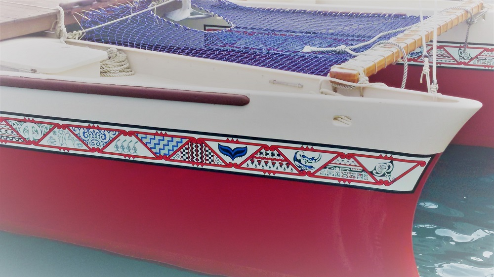
Towards the end of the demonstration, the group moves to the boat dock and boards the beautiful, traditional Polynesian Okeanos Vaka Motu, a 14-metre elaborately adorned catamaran part of an eco-tourism operation which transports visitors between local islands powered by only the wind and coconut oil. The national representatives stand proudly along the bow of the catamaran, holding up flags and banners, their traditional costumes waving in the wind. Onlookers, locals and tourists alike, cheer and clap, stomping in time with the chanting. The man with the megaphone brings a large triton shell to his lips and blow hard, emitting a curiously deep, wailing sound. He blows it three times and then the protest is over and everyone stops to chat, admire the beautiful boat, approach the multinational assembly and ask questions about the cause.
Bow details of the beautiful Okeanos Vanuatu catamaran.
Climate change is only the latest threat in the long, brutal history of Vanuatu. The area was originally settled by the Lapita people (ancestors of Polynesians originating from Taiwan) about 3000 years ago. Around 700 AD, Melanesians arrived from the Solomon Islands displacing the Lapita entirely. For centuries thereafter, the islands were populated by autonomous clans who spoke different languages and raided each other’s villages, eating abducted victims to bodily incorporate their spiritual power.
Europeans entered the picture in 1606 when the Spanish Pedro Fernandez de Quiros sighted (and named) the island now known as Espirito Santo, thinking he had reached the elusive southern continent Terra Australis. He was attacked by locals and had to retreat, and subsequently, Vanuatu was visited by the French (Bougainville) in 1768 and James Cook (who named the area the New Hebrides) in 1774. Sandalwood traders began operating in the area from 1825 onwards; these paid for the wood with guns, tobacco or men from neighbouring villages to be cooked for important ceremonies. The traders treated the indigenous people abhorrently, occasionally taking to distributing smallpox blankets to clear areas of locals to ease access to the prized wood.
When Christian missionaries were sent from the London Missionary Society in 1839 the Ni-Vanuatu (people of Vanuatu) were tired of foreigners, and the new arrivals were promptly clubbed and eaten. After this, Polynesian missionaries were sent from Samoa, but these too sustained heavy losses and the mission was aborted until 1848 when Vanuatu’s Presbyterian mission was established on the island of Aneityum. Blackbirding, the coercion or kidnapping of villagers for use as poorly paid labour on sugar cane plantations in Australia and Fiji or nickel mining in New Caledonia, was rife, resulting in the departure of 50,000 Ni-Vanuatu men between 1863 and 1904, leaving many villages missing half their men. Few returned, although any surviving labourers in Australia were abruptly deported in 1906 when the White Australia Policy came into force.
When the Germans started to show interest in the area, the French and the English set up the Anglo-French Condominium of the New Hebrides and formally settled the islands. Close contact with missionaries, settlers, and smallpox purposefully introduced by the sandalwood traders, resulted in rampant disease which reduced the Vanuatu population from an estimated one million prior to European contact to 41,000 in 1920.
The French and the English continued to administer the islands jointly until rising discontent about land ownership (30% of the land was owned by French or English planters) led to a protracted and bloody struggle which culminated with independence in 1980.
Nowadays, the population of Vanuatu is about 280,000. The economy is mainly based on copra (coconut), beef, coffee, cocoa, and tourism is becoming more important.
Presently, climate change is the most significant threat to sustainable development in Vanuatu, mainly because of the predicted increase in extreme weather event associated with global warming. The main risk is increased frequency and severity of cyclones. In 2015, Cyclone Pam affected 64% of the economy, 60% of the population, and destroyed 96% of the country’s food crops. Apart from cyclones, other climate-related adverse effects to this tiny island state include its fisheries being impacted by rising ocean temperatures and ocean acidification, and the islands being inundated by sea level rise and associated coastal erosion.
Poster urging action from Australia’s new prime minister, Scott Morrison, an ardent climate change denier. Morrison got to power in late August 2018 as the result of a revolt within the country’s right-leaning liberal party, which arose when the previous liberal prime minister, Malcolm Turnbull, proposed to address climate change.
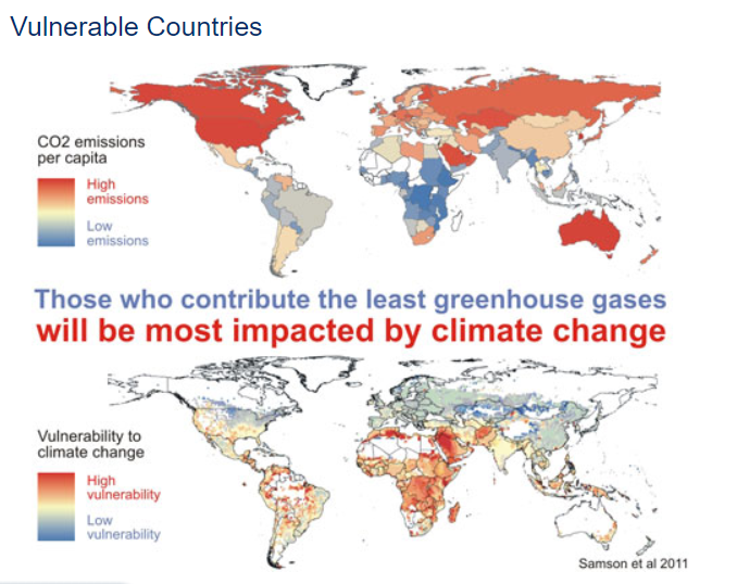
Currently, it seems a hopeless struggle. The South Pacific states contribute almost no greenhouse gases to the atmosphere, but as low-lying island states in the cyclone belt, they are disproportionally affected by a changing world. It is great to protest, and I hope with all my being that the world is listening to the South Pacific, heeding the warnings and fulfilling the heart-breaking messages of the paper placards:
We are people of the canoe, we are resilient to climate change
We’re not drowning, we are fighting
Honour Earth all life depends on it
Map showing the contribution towards climate change of different nations (top) versus risk of adverse effects. The countries most at risk are not the ones causing the problem – a matter keenly felt by the South Pacific nations. Source: Samson et al. (2011) Geographic disparities and moral hazards in the predicted impacts of climate change on human populations. Global Ecology and Biogeography 20 (4). https://doi.org/10.1111/j.1466-8238.2010.00632.x.
I admire the action day for its clear action focus – rather than just protesting, the slant is that everyone should join the battle to combat climate change. It is a strong and empowering message, urging Ni-Vanuatu to do something about the largest issue looming over their world today. But unfortunately, their influence over the core problem is minimal. They can work with NGOs and government organisations to increase resilience, to plan for more erratic climate, more frequent cyclones, reduced fishing crops. They can retreat from low-lying areas and plant different crops in new areas in an attempt to outsmart the weather. They can convert local vehicles to biodiesel from sugar cane and use the solar panels distributed by foreign aid organisations to minimise their own greenhouse gas output.
But the truth is that even people of the canoe can drown in a world of a couple of metres of sea-level rise. And going down fighting does not right this last in a long string of wrongs that the western world has imposed on Vanuatu since first contact.
I hope this demonstration, one of many taking place across the South Pacific to increase awareness and urge action on the issue, doesn’t fall on deaf ears.
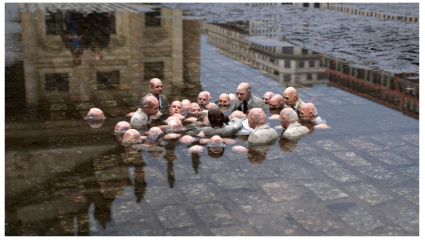
A poignant piece of street art from Berlin that I stumbled over online. Made by Isaac Cordal, it is entitled ‘Follow the Leaders’.
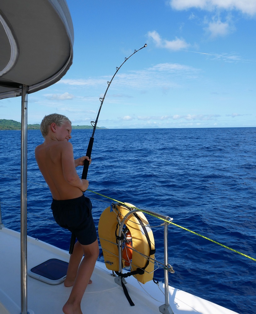
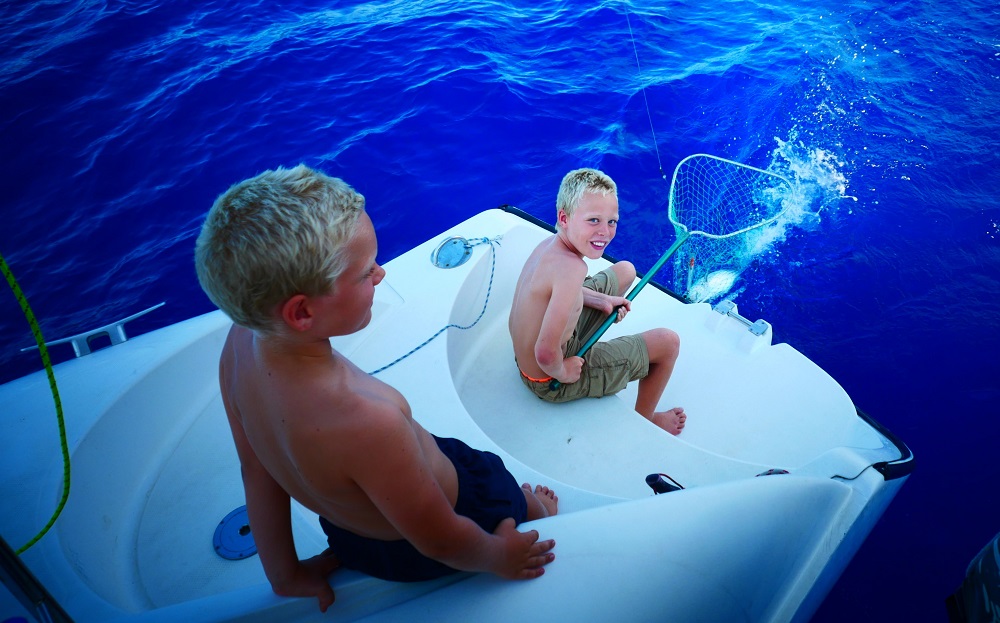
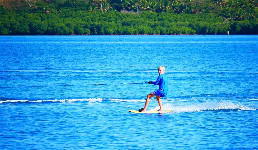
Weee! Over the last two weeks, me and Lukie went kitesurfing and wakeboarding.
Wakeboarding is when you get a kiteboard and you hold a rope with a handle on the end. The rope is tied to the dingy. To get up the dingy drives forward and you get pulled along while you hold onto the handle.
MatiasDaBoss!
If you let go of the handle you will start sinking because you have nothing to hold you up (unless you are going really fast, then you skid along the water for about five seconds). Sometimes we fall off (it can be quite brutal, I fell and bumped my forehead). Here are some pictures, enjoy!
Me dying.Aaargh!Slam!
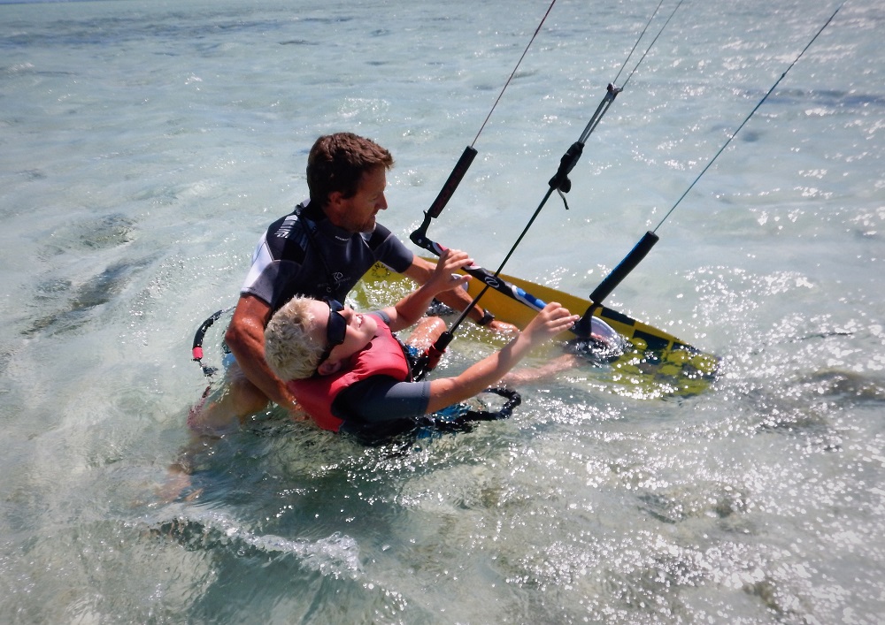
Wakeboarding is really fun but also quite difficult. Kitesurfing is also really hard until you get it. I managed to get up on the board and I went flying at about a hundred kilometres an hour. I flopped the kite on the water, so I could stop. Man, kite surfing is fun but also super-duper scary. I ham, I mean I am, so happy and grateful that I got up.
Me getting up.Me kiting to Tonga!Lukie with sunnies trying to get the feel for the board.
Lukie is about to get up, he is getting the feel for the board. We do this kite surfing on a sandspit in Musket Cove. The sandspit is perfect for starters and getting up on the board.
On Friday we are leaving for Vanuatu. It will be a four-day passage so before we go we need to reinforce our food supplies. Today we are leaving to Denarau to stock up until Friday.
For home-schooling, Lukie is doing an inquiry about saltwater crocodiles and apparently they live in Vanuatu, and we are going there! Oh no, I knew it would end this way. “Really?” says Lukie. “No, I didn’t know it would end this way.” But it might, you never know. Do you know?
Another thing is that saltwater crocodiles can swim very far. Maybe even to New Zealand!
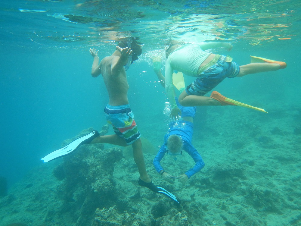
Yesterday we went wakeboarding with a friend called George who we also snorkelled with. We went snorkelling just behind the sand spit on an abyss going down to about two hundred (I think) meters in depth.
Snorkeling with George.Ninja coral which sneaked up on me.Moray eel.Crawl. “Goodbye.” Crawl, crawl, crawl.
Once upon a time, a beautiful princess, Yalewa-ni-Cagi-Bula (Lady of the Fair Wind) lived on a small island in Fiji. Of godly descent, she was the fairest of all women in Fiji; her beauty stunned all who beheld her, and any man who had set eyes on her was in awe and wanted her to become his wife.
Her home was an emerald green saltwater pool in a cave behind the ragged rocks that guard the western shores of Vatulele Island, over the seas from Viti Levu. Her beauty was so famous that chiefly warriors came from all over Fiji and beyond, from the whole of the Pacific, to ask for her hand in marriage. Each suitor brought a gift which they presented to the fair maiden, hoping that by bringing her earthly goods they could persuade her to marry them.
The princess was as picky as she was beautiful, and refused suitor after suitor, deeming them unworthy of her love.
The son of the highest chief in the north came bearing the tastiest fruit, asking for her hand. She asked him where the fruits were from, and when he spoke his home island, she refused him haughtily, saying that only fruits from heaven would be sweet enough to match her beauty.
The son of the highest chief in the south came bearing the shiniest pearls, asking for her hand. She asked him where the pearls were from, and when he spoke his home ocean, she refused him disdainfully, saying that only pearls from heaven would be shiny enough to match her lustre.
Finally, the son of the highest-ranking chief in the whole of Fiji came to ask for her hand, bringing a gift of succulent cooked prawns wrapped in banana leaf. She asked him where he was from, and he pointed just over the eastern horizon. She laughed scornfully and said that only a man from the heaven above would be supreme enough to match her divinity. Outraged, the chiefly warrior flung the prawns at the beauty, and when they scattered into the pond surrounding her they were restored to life. And that is how the prawns in the pond in the cave at Vatulele Island are red even when they are alive, unlike all other prawns who only turn red when they are cooked.
The ura mbuta, or ‘cooked prawns’ are rare, and to this day sacred to all Fijians. Visitors to the pond will sometimes see Yalewa-ni-Cagi-Bula at the cave but to locals she remains hidden. If the goddess is unhappy with you – if you haven’t presented your gifts to the chief of the island – no prawns will show themselves to you. If she is happy with you, the prawns will be out in great number.
Sacred prawn.
Mele smiles and takes a step back from Korolamalama Cave. We stand beside him, surveying the crystal-clear water and the red dots of prawns scurrying hurriedly around. There are plenty, so we must have followed good protocol when we did our sevusevu in the village. The pool is enclosed by vertical limestone rock, beyond which the coastal forest stretches, intercepted here and there by sharp rocky outcrops. The trees are big and tall, with thick, heavy roots spreading and rising far above the ground into a tangled mess of thick vertical branches. Behind the cave, a steep limestone wall rises perhaps 25 m from the ground. Trees poke out of the rock at the top, clinging to the limestone cliff with their roots stretching all the way down the side of the cliff to the bottom.
Large coconut crab crawling up tree roots hanging off the cliff.
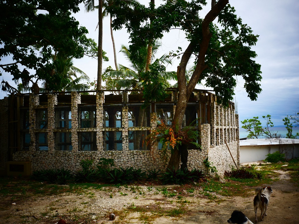
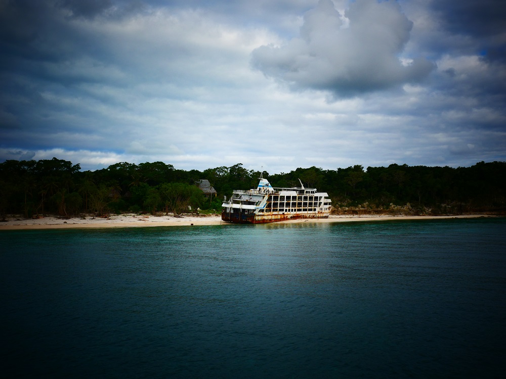
The cave is not far from where we are anchored alongside a beautiful white beach on the western side of Vatulele island. Flanking the beach is an abandoned resort, complete with 19 bure (Fijian-style huts used in tourist accommodation), a white clifftop mansion, and several unfinished buildings on the foreshore. And a huge ferry wreck, a rusty death trap measuring 60 metres in length, which is parked on the sand at the southern end of the beach, just in front of the resort’s pink honeymoon suite.
Stunning coastline.
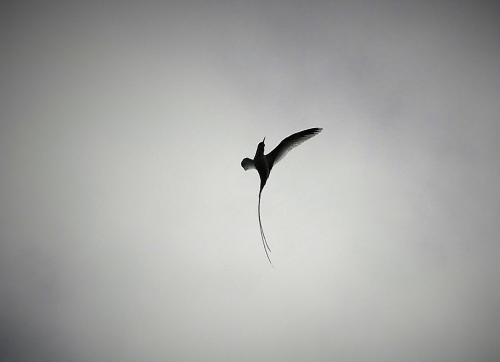
It is a stunning location. The outer reef is not far from the beach, the glassy lagoon providing calm waters for safe swimming and snorkelling on the many coral outcrops. The resort faces west which makes for spectacular water sunsets. White tropicbirds fly from the bush, their long tails clearly outlined against the deep blue sky. Whales pass on the outside of the reef, large black lumps passing by, clearly seen from the beach.
Wispy tropicbird in flight.
Forsaken since 2015, the resort has had four different owners since it first opened in 1998. The exclusive holiday accommodation was built at great expense by two Australians in a New Mexico – Fijian fusion style and for years the five-star resort was the most expensive destination in Fiji. The current owner, the multi-millionaire French-Australian Albert Bertini, closed down the resort when he ran into cash-flow problems after spending in excess of A$20M on building additions which now stand half finished on the foreshore.
Bertini, 50, was holidaying at the resort in 2011 when he decided on a whim to get married to his 24-year-old girlfriend and to buy the resort they married in to boot. The resort was in receivership at the time, and shortly after Bertini took over in 2012 he started renovating and building. A property tycoon worth an estimated A$400 million, Bertini started developing at full pace. It was around this time that he declared bankruptcy in Australia and fled the country leaving a string of creditors in his wake.
He began renovating the existing bure and started a string of new building projects, including a second floor on the white honeymoon villa to house his extensive wardrobe; more holiday accommodation at the back of the site; a stone-clad indoor garden sporting a Grecian design with 200 glassed windows hemming in a small grove of coconuts behind a swimming pool facing the beach; and a bunker-like protrusion on the foreshore, entirely clad in black mirrors, a building used as a storage facility for materials for the many building projects. His vision was to turn the resort into a paparazzi-free party venue for the rich and famous, a vision which he successfully persuaded a number of celebrities to invest in.
A half-finished building with 200 windows stands abandoned on the foreshore.
According to the villagers, he would tear the new buildings down as fast as he erected them, finding faults and changing his mind, leading to an endless cycle of building where nothing was ever completed.
The rusty ferry was his final touch, a departing gift to the site. Intended to be reconfigured to become a nightclub, he pulled it ashore at great expense, only to abandon the entire resort not long after.
Rusty ferry awaiting transformation into celebrity nightclub.
The resort is still beautiful, although neglect and the weather have taken their toll. Discrete from the outside, the insides of the bure are amazing with exquisite tapa cloth covering the ceilings entirely.
Tapa cloth covering the bure ceiling
Horrible damage was done to the resort by Cyclone Keni in April this year, which resulted in standing waves higher than 15 m and flooding of the forward row of bure, carrying sand and debris into the beautiful buildings. The cyclone winds blew off roofs and smashed the mirrors lining the concrete bunker on the beach, leaving a devastation of broken glass, wrecked concrete and huge boulders strewn across the foreshore. The cyclone also smashed the ferry apart and moved it further along the beach where it now lies blocking the views from the honeymoon suite. All over the western side of the island, trees were uprooted, and because nobody has bothered cleaning up the site, the carnage is still clearly visible.
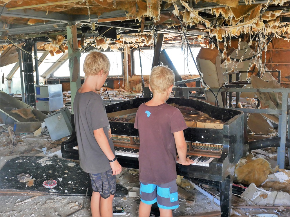
The rusty wreck as seen from the beach.Dilapidated piano left in the ferry.
Mele works at the site as a security guard. He doesn’t know when the resort will be reopened but knows that Bertini is looking for buyers, and a few have come looking in the years it has been closed. Bertini is in and out of Fiji, where he has several court cases on the go, the charges including fraud and assault. Until the resort reopens, Mele is employed to keep the villagers from plundering wood, roofing, pipes and other goods. He’s from the village himself, the cousin of the chief, but lives onsite where he takes care of the two lovely dogs that Bertini abandoned.
On our last day on the island, Bertini turns up with a mate to pick up some clothes. I bump into him deep in the forest where I’m looking for rare birds. A short, wiry man clad in a white singlet, vertically striped pants, a bandana underneath a torn cap worn back to front and handmade Italian loafers, he resembles an eccentric trapeze artist on the run from Cirque du Soleil. Around his neck is a bolt tied into a leather string. On his left shoulder is a tattoo of a dark-haired woman, her hair running down his wiry arm, almost reaching his elbow. He speaks fast with a lot of hand movements and very intense eye contact.
“You should never do business in this country, never. The government will just fleece you, as soon as they discover you have money, they will just ask for fee after fee, charging you for everything, asking you to renew licences and pay more and more, until you have nothing left. What they want is for you to develop the place and then run out of money, and then they can take it over.” He takes his cap off, adjusts the bandana, and puts the cap back on.
His speech is littered with celebrity name dropping and references to all the money he’s lost, what the resort is worth, so many million-dollar figures that I have problems keeping track of it all. He reckons that the place is worth US$28 million, or perhaps it was US$32 million. He’s lost a lot of money, perhaps US$7 million a year, for at least the first two years, although that may have just been to the Fijian banks, or perhaps the Fijian government.
He loves Vatulele and has spent long periods, or perhaps 18 months or maybe just a month, here on his own, a time where he really got to know the rhythm of the place, learning when the turtles swim and the birds fly. He’s been awake at night when the moon is as bright as daylight. He’s explored everywhere and has found amazing stuff. Lost cities, with columns and carved head statues resembling those found at Easter Island. Blue holes and caves that nobody knows about. He has a deep spiritual connection to the site, the villagers, and the whole island. He really wanted the villagers to benefit from the resort, wanted them to run it, and he has helped them lots, building many houses, and looking after the old chief after he got a stroke.
His friend thinks that Fijians are just lazy and that the Indian-run government is ruining the country, taking it away from the indigenous Fijians. Bertini thinks that the laziness is partly the kava, that it’s like in the US where they drug their citizens, turning them into fat blobs that just sit and watch TV. In Fiji, it’s the kava drugging them all.
Now, reluctantly, he is giving up on the resort. He has subdivided his lease (the land is owned by a local on the island, but Bertini holds a 99-year lease) and is having it all valued, and it is worth perhaps US$24 million or maybe it was $34 million.
When I mention that I like the dogs he left behind, he offers that we can take one of them with us.
“Take her, you can take her with you, she loves boats,” he offers generously.
Having been here for a few days, we know that she loves boats – as soon as she sees us on anything that floats (paddleboard, kayak, dinghy), she swims out excitedly and tries to jump on board. If we refuse her advances she swims after us desolately for hundreds of metres, puffing for breath and guilting us with her big brown eyes.
The dog on the paddleboard.
The villagers allege that Bertini had a drug problem, but that kind of goes with the territory if you are a multi-millionaire wanting to develop an island for celebrities to ‘party on’ unwatched. Many mention that they did not like the direction the resort was taking, and the friends he was bringing. But they also acknowledge that had it worked out, they would have thought of him as a genius.
“If it works, he is brilliant,” comments one man. “If it doesn’t, he is a fool.”
It didn’t work, and now he is not much liked in the island’s main village.
We got all the gossip the first day when we went to the village to do our sevusevu.
“Everybody used to work in the resort,” explained Oona, the chief’s wife. “Then when it closed, suddenly there was no more work. We all want the resort to reopen, it was good for the village, good for the island. Now all we have is tapa.”
Tapa is the cloth made from the bark of the mulberry tree, and Vatulele is famous for the fine quality of the tapa they produce. The rhythmic beating of wood on wood can be heard miles away from the village, a loud, persistent dissonant banging pulsing out to sea and into the backland bush.
The banging comes from the production of tapa cloth. Each man on the island owns a stand of mulberry trees, and each woman works six days a week on the production of the valuable cloth. First, she strips the bark from the straight stem of the masi, as the tree is called in Fijian. Then she peels off the outer skin of the bark, leaving her with a white, pliable stretch of shiny bark. She next soaks it in seawater and then pounds the softened bark for hours until it forms a thin, white mat. The mat is dried in the sun, and once completely dry it is decorated with geometric patterns to make the coveted tapa cloth.
Detail from tapa cloth, showing the sacred prawns, tropicbirds, and ancient rock paintings of round faces.
The cloth used to be used as clothing by chiefly persons but nowadays is used as decorative wall hangings, table mats, or as wrapping for important gifts.
It is a lot of work. All day the women thump wood on wood, gradually working the bark fibres into each other, thinning the bark by mercilessly beating it, spreading it out with blunt force.
It’s a world away from catering to hard-partying celebrities, but with the way things turned out it is good that tapa making survived on the island. By village standards, it’s a lucrative industry, and the village appears wealthy, with many concrete and brick houses although these were probably built by Bertini.
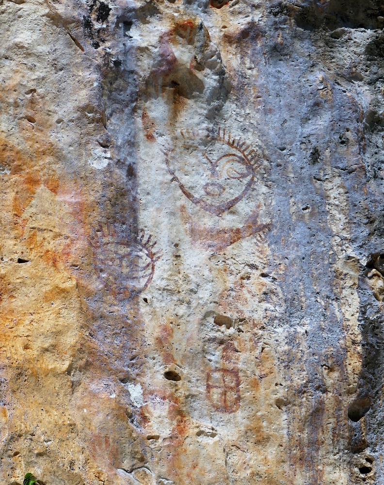
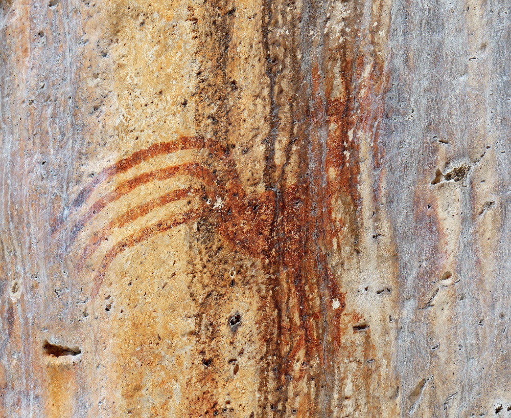
In addition to the ghost resort, the red prawns and the beautiful cloths made by the charming villagers, Vatulele sports ancient rock paintings along the steep western cliffside. According to Bertini, the paintings are 3000 years old, made by the Lapita. (Originally from Taiwan, the Lapita are named for the distinctive pottery that characterises the archaeological sites where their remains are found. They colonised the Pacific in progressive waves of eastward expansion and are thought to be the ancestors of modern Polynesians. The earliest humans to inhabit Fiji, the Lapita were mostly displaced in Fiji by a large influx of Melanesians originally from Papua New Guinea. Today’s indigenous Fijians are a unique mix of Polynesian and Melanesian heritage, in contrast to more eastward islands (like Tonga, Samoa, Tahiti, Hawai’i, and New Zealand) where there are only Polynesians, and more westward islands (like Vanuatu, the Solomons, Torres Strait Islands and Papua New Guinea) where there are only Melanesians.)
The rock paintings sit high on the steep cliffside. They depict chickens with long finger-drawn tails, handprints and round sun-like faces, immobile images looking out over the calm lagoon, providing a rare window into a past culture that left no written records. The paintings are faint in places, faded by the sun and rain, and I wonder how many have already faded out of existence, and how long the remainder will last in this exposed location. In one place, a large piece of rock has been cut out; apparently, a beautiful octopus used to be there, but someone removed it out to keep for themselves. The cliff face used to be behind a stand of trees, but Cyclone Kenny smashed the vegetation and now they are open to the elements.
Faces in the rock.Rock chicken.
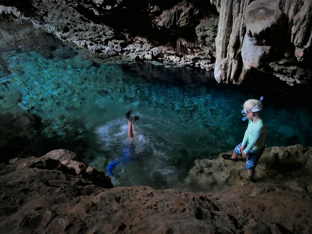
On our last afternoon, at Bertini’s urging, we visit the crystal caves, a large inland underground system which is flooded with saltwater. The cave ceiling is made entirely of crystals spilling down in lumpy bouquets like the heavy petals of a succulent flower. When you shine a torch on them they sparkle and glitter, a brilliantly shiny contoured ceiling made from crystal chandeliers. The crystals extend underwater, and the cave looks like it goes on forever, stretching darkly under water in the direction of the sea.
Glittering crystal shapes in Crystal Cave.Crystal cave shapes.Swimming in dark caves.
Like at Yalewa-ni-Cagi-Bula’s pond, faces, figures and ethereal shapes appear everywhere in the limestone rock, and it is easy to see how such landscape could inspire a deep spirituality, giving rise to legends and the ancient sun-like faces painted on the rocks of the coastline and Bertini’s ties to the island alike. Hopefully, he’ll find a good buyer for the resort, someone with plans that align better with the villagers’ aspirations.
When we leave, the dog sits on the beach looking mornfully after our boat.
“Is something burning in the kitchen?” asks David. He’s leaning into the saloon from the cockpit, a dark shape backlit by the setting sun.
I look up from the steaming stove where I’m painstakingly stirfrying vegetables one small bunch at a time to ensure perfect crispness. “No,” I say. “Everything is fine here.”
“Are you sure?” he leans further in, sniffing the fragrant air. “There is, like, ash coming out of the kitchen side hatch. I’m pretty sure it’s from the kitchen.”
“Nope.” I turn my back to him to fish the carrots out of the pan and place a small portion of carefully cut chicken strips in the hot oil. “No fire here. And I’ve had the hatch closed the whole time I’ve been cooking. So must be from somewhere else.”
“Weird. Maybe the villagers are burning rubbish or vegetation on the shore.” He lingers a moment longer in the doorway before heading back out into the cockpit.
“I hope it’s not another volcano!” I shout after him.
Last time there was ash on deck it was a volcanic eruption in Vanuatu, about two weeks ago just when we were getting ready to leave the Lau Group for Suva. We woke up one morning to find the boat covered in a substantial layer of fine ash, and after a little investigation discovered that the source was about 700 miles away, on Ambae island in Vanuatu, the huge ash cloud from which had been carried by winds to Fiji where it settled out over the sea, the land and our boat. The ash cloud disrupted Air Fiji flights for a couple of days, and one can only imagine how bad it must have been in Vanuatu.
Back then it took us days to clean up the mess, washing and wiping grey residue from our fine white deck, scrubbing black footprints from the cockpit flooring.
Now we’re at Ono Island, in the north Astrolabe reef by Kadavu, a large island 150 nautical miles south of Viti Levu, and I’m hoping this is not another volcano.
David comes back in as I’m draining the noodles. “I can see it now, there’s a fire on the shore, behind the palms. Probably just the villagers burning rubbish.”
“Great,” I say, wiping the hot steam from my brow with the back of my hand. “Well, dinner is ready, so can you please ask the boys to set the table?”
It is not until after the kids have gone to bed that we notice that the fire hasn’t gone out. It is now completely dark, and it is clear that the fire has spread: from the isolated spot behind the near-beach vegetation where David saw it, it has now conquered half the hillside. It is definitely out of control – the flames are licking up trees and as we watch it spreads rapidly, the red glow above the yellow flames lighting up the sky, the inferno reflected in the still water below. We can hear the roar and crackle as hundreds of trees combust, and the smoke is billowing over the boat as it moves out through the calm bay through the still night.
The hillside is alight
David and I sit watching it in horror for a while. I cough. He coughs. I rub my eyes – they are stinging from the smoke. He rubs his eyes. I cough again.
Thick smoke is now rising in a tall column off the hillside, visible against the fire-illuminated sky. We’re directly downwind and are getting the full fallout. The deck is covered in charred fragments of vegetation, piles of ash are nestling in against the steps at the stern.
Over the roar of the fire, we can faintly hear Matias cough from deep within the boat.
Finally, at 11:45 pm we stir. David says, “We better get out of here. We can’t stay in all this smoke, and it’s not getting better, there’s no sign of it abating.”
“But we can’t move the boat in the dark!”
“I think we’re going to have to.”
You need great visibility to move around in shallow bays with numerous uncharted coral reefs just below the water surface. Normally, we only move when the sun is out, and once out of open water one polaroid-sunglass-wearing person is always standing watch at the bow, pointing out the reefs that emerge as we draw closer to shore.
Now, it is midnight, the only light available the red glow of a raging bushfire.
I swallow in dread, and as David starts the engine I get the large torch out. We hoist the anchor and slowly creep around the coastline towards the bay where Naqara village is located, figuring that it is upwind from the fire and so unlikely to yield much smoke – and that if it does, the villagers will almost certainly need our help. Fish jump out of the water, startled by the torchlight I beam ahead of the bow, and every time I hear a splash I fear that it’s a reef, that we’re about to crash.
But in time we make it to the middle of the village bay and find what appears to be a flat, feature- and reef-less bottom. We put our anchor down with a sigh of relief. The village is completely quiet, only one light on, and no people can be seen moving even though half the hillside beyond it is engulfed in flames.
After watching for a while, we go to bed and are lulled to sleep by the crackling fire, the smell of smoke lingering in our nostrils.
In the morning, smoke is still rising from beyond the village hills. Boats are buzzing to and from the village, but thankfully everybody is fine, no damage to any houses. Just another rubbish fire going out of control.
Morning smoke…
The bay that burned was one that is used for film sets from all over the world. Fiji is a choice location for Survivor Series and tropical movie-making alike. When we visited Naqara a couple of days earlier, Job the chief talked about how the village-owned bays are booked out for filming for the next five years.
“This year it is the Sweden Survivor movie,” he said as he was walking us back to the dinghy after the sevusevu. “They have already built all the things they need, and they will spend 40 days here filming.”
He gestured beyond the steep hill towards the bay beyond. “They will stay on that beach over there, and on that island there, and on that beach too.”
“Wow,” said David. “So you’re busy with that.”
“Yes.” Job wiped his brow as he was wading through the shallow water. “After the Sweden, we have the Survivor France, and then after that the Sweden again.”
He glanced out over the shallows. “And then the year after that it is the Poland Survivor, and then the France again, some Robinson Crusoe show. And then maybe the USA the year after that.” He smiled.
“Wow,” David said again. “That is great, everybody coming here to film their movies and Survivor series. Well, I guess it is not a bad place to survive…”
“Yes, it is very good for us,” says Job. “Very popular to come here, and the villagers get work from it.”
Perfect scenery for movies.
Now, we just hope that the fire hasn’t disrupted the busy filming schedule.
It is a beautiful place, perfect for tropical idyllic island moviemaking. In the quiet village bay the steep hillsides are reflected in the deep green water, the water so calm that it offers a perfect mirror image of the hills and the clouds. The beach in the bay they will film in is white, coconut palms in the background, and inland vegetation lush and dense. The bay is fringed by a coral reef teeming with fish. Birds swish through the sky everywhere, landing noisily in trees.
Spadefish off the coral reefs in the North Astrolabe reef.
Now, the vegetation behind the palm trees is scorched, but the setting still looks nice, just a bit more mysterious and menacing. We think it’s the perfect setting for a survivor show and hope that the Swedes agree. It is lucky that they haven’t arrived yet – we’ve seen them scope the area, but they are not yet living there. Just as well – imagine the liability if a whole Survivor Series perished from on-set smoke inhalation.
It is great that Fiji can make money from the film industry. In 2017, 74 productions were shot in Fiji, which according to the Fiji Sun generated new economic activity of about FJ$350M. The USA Survivor show alone generates seasonal employment for 300 Fijians. It is a neat source of income for a developing country.
Sharpening wooden sticks ready for Orc attacks.It’s not just the international movie makers that want to survive outdoors in Fiji.
On our boat, the kids are increasingly keen to spend a night sleeping out by themselves on the shore. We have been trying to find them a deserted island to go to, and in the meantime, they’ve been camping out on the foredeck trampoline as a compromise.
It’s all part of the continued Lord of the Rings games. As they’re reading their way through the books it permeates everything we do, and presently they are deeply immersed in a game where the Elf Thamior (aka Lukas) and the Dwarf Thorin (Matias) find themselves in enemy territory, on a deserted beach backed by palm trees and steep bush-covered hills. Faced with such obstacles the two make plans to survive, collecting seashells, nuts, seeds and pieces of wood, all of which represents edible substances that will help them live through the night and face another day. Monsters lurk behind every corner, and as nightfall nears the two plan for a safe survival of the night, strategically storing their food, and identifying nearby cave-like shelters that might provide refuge should it rain.
The characters have evolved over time, and it is now clear that the Dwarf is rather foolhardy, recklessly tumbling headfirst into dicey situations, to the great frustration of the more reticent Elf, who deep down doesn’t really like risking his life that much. They are a good pair, though – without the Dwarf the Elf would never go anywhere, and without the Elf, the Dwarf would surely die within minutes.
And even though we encourage adventures and independence, we are very grateful that we didn’t let them sleep ashore by themselves on the night of the bushfire.
But Kadavu is not all surviving, smoke and movie sets.
Manta soup – filterfeeding at high tide.
The water between the islands just north of One Island teem with manta rays. The sea there is like manta soup, and everywhere we go we see them, huge black diamonds hanging just below the water surface, waving their fin tips out the water as if to warn us they are there.
At 2-4 m across they are incredible to see up close, gentle giants gracefully gyrating, twisting, twirling, looping, mouths gaping as they suck up plankton from the rich waters. When they are feeding they come across as hollow, just a cavernous mouth opening up into a rib cage, slatted gills clearly visible on their underside. We swim and dive with them and look on in amazement.
Matias approaching a manta ray much larger than himself.Lukie checking out the remora clinging to the underside of the manta ray.David checking out a manta ray being cleaned by patient, tiny cleaner wrasse.Just one huge cavernous mouth leading into a hollow interior.Elegant like a soaring bird flanked by remora.Frantic feeding.
Further south, on Kadavu Island proper we anchor in steep-sided bays and hike to inland waterfalls, swimming in the crystal clear pools below the thundering cascade. We travel up long rivers through mangrove swamps, spotting colourful native parrots, birds of prey and the occasional bat.
40-metre waterfall.Quiet, long rivers reaching inland through miles of mangroves.A drowned forest at the inland end of the river.
Travelling along the Kadavu coast we see fires everywhere, steaming smoke coming out of every hillside. We’re not sure how many of them are intentional but know that the pine plantations on the island are often burned off after felling and that elsewhere wild yam are harvested through burning the vegetation. But wildfires are common too in the dry season, destroying vast swathes of Fijian land every year. It certainly is fire season: it seems that no matter where we anchor we accumulate ash on deck, and after a while we get used to it, brushing off the soot and washing the deck carefully every morning.
Tomorrow we will leave Kadavu for Vatulele, a small island on the way to Viti Levu. Hopefully, the fire risk will be less there.
Now, you might be wondering what we do on passage and on anchor.
On passage, Lukie and I spend hours on the tramp. We sit down and wait for big waves to come washing over us. We put on life jackets and run, holding on to things like the railing and the floor, to the wave zone (the tramp).
The waves crash up and we try not to swallow any water. We flip, roly-poly, bounce and fly onto the deck. Sometimes the cockpit gets filled with water or the water comes up through the floorboard just outside the door.
On anchor, I mostly spend hours swinging on the ropes at the front of the boat.
If the water looks nice, it always does, me, Lukie and Daddy jump in the water and do challenges.
Yoda!!!!!!!!!!
Some of the challenges are: jump in and swim under both hulls, see how far down you can go and who does the biggest bombs. We are all trying to achieve the Triple Yoda.
The Triple Yoda is where you jump in the air and spin three times around before you hit the water. The best any of us have done is the Double Yoda.
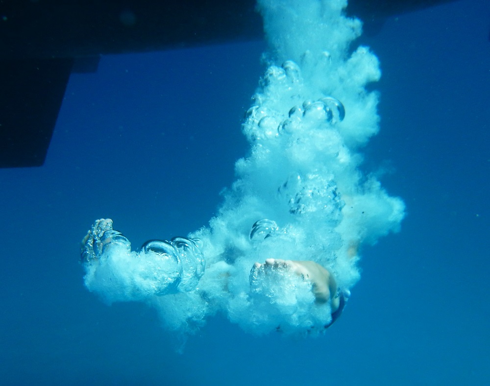
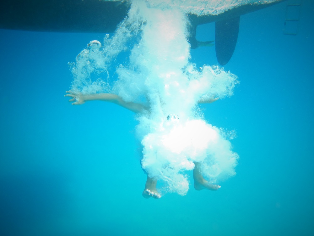
Far down in the water lives an evil bubble monster.Another bubble monster.A not so bubble monster.
On anchor, we (me and Lukie) play Lego Star Wars, Lego city and Lego random (lots of different types of Lego joined together).
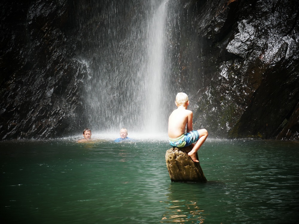
The thing that we do the most now is play Lord of the Rings. We play that on shore, on the boat and mostly in forests. Just yesterday we all went up a mountain to a waterfall in the middle of the forest (perfect for Lord of the Rings). We went swimming in the waterfall but we didn’t stay long because it was so cold!
Me under waterfall, Lukie on log.
I’m a fifth through reading the Lord of the Rings books.
Me and Lukie also play a game called Dungeons and Dragons. I cannot explain much because it is so complicated. I can explain that it is a game where you use your imagination and lots of bits of paper. It is a fantasy land where you can do anything you like, and you have a character that you make, and you travel around and complete adventures. I make up the adventures and Lukie plays them.
When other kids come on board we usually play Lego, Minecraft and Pokemon cards. We also jump in the water with them and draw.